
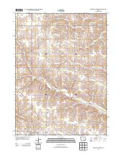
~ Grinnell North IA topo map, 1:24000 scale, 7.5 X 7.5 Minute, Historical, 2013
Grinnell North, Iowa, USGS topographic map dated 2013.
Includes geographic coordinates (latitude and longitude). This topographic map is suitable for hiking, camping, and exploring, or framing it as a wall map.
Printed on-demand using high resolution imagery, on heavy weight and acid free paper, or alternatively on a variety of synthetic materials.
Topos available on paper, Waterproof, Poly, or Tyvek. Usually shipping rolled, unless combined with other folded maps in one order.
- Product Number: USGS-5941947
- Free digital map download (high-resolution, GeoPDF): Grinnell North, Iowa (file size: 23 MB)
- Map Size: please refer to the dimensions of the GeoPDF map above
- Weight (paper map): ca. 55 grams
- Map Type: POD USGS Topographic Map
- Map Series: US Topo
- Map Verison: Historical
- Cell ID: 18587
- Datum: North American Datum of 1983
- Map Projection: Transverse Mercator
- Map Cell Name: Grinnell North
- Grid size: 7.5 X 7.5 Minute
- Date on map: 2013
- Map Scale: 1:24000
- Geographical region: Iowa, United States
Neighboring Maps:
All neighboring USGS topo maps are available for sale online at a variety of scales.
Spatial coverage:
Topo map Grinnell North, Iowa, covers the geographical area associated the following places:
- Gates Residence Hall - East Campus Residence Halls - Paul W Ahrens / James Paschall Memorial Park - Clark Residence Hall - Sonora (historical) - Calvary Baptist Church - President's House - Physical Education Complex - Norris Residence Hall - Sonora Post Office (historical) - Fairview Elementary School - Chester Church - Jane Springer Sports Field - Chester Center Post Office (historical) - Township of Chester - Les Duke Track - Merrill Park - Van-Horne Park - KGRN-AM (Grinnell) - Grinnell Country Club - Rawson Residence Hall - Cowles Residence Hall - Ward Field - Immanuel Lutheran Church - MacEachron Field - Chester Cemetery - Conney M Kimbo Black Cultural Center - Chester Cemetery - Gale Observatory - Rosenbloom Football Field - Grinnell High School - Chester - Dibble Residence Hall - Harris Center
- Map Area ID: AREA41.87541.75-92.75-92.625
- Northwest corner Lat/Long code: USGSNW41.875-92.75
- Northeast corner Lat/Long code: USGSNE41.875-92.625
- Southwest corner Lat/Long code: USGSSW41.75-92.75
- Southeast corner Lat/Long code: USGSSE41.75-92.625
- Northern map edge Latitude: 41.875
- Southern map edge Latitude: 41.75
- Western map edge Longitude: -92.75
- Eastern map edge Longitude: -92.625


