
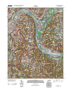
~ Newport KY topo map, 1:24000 scale, 7.5 X 7.5 Minute, Historical, 2013
Newport, Kentucky, USGS topographic map dated 2013.
Includes geographic coordinates (latitude and longitude). This topographic map is suitable for hiking, camping, and exploring, or framing it as a wall map.
Printed on-demand using high resolution imagery, on heavy weight and acid free paper, or alternatively on a variety of synthetic materials.
Topos available on paper, Waterproof, Poly, or Tyvek. Usually shipping rolled, unless combined with other folded maps in one order.
- Product Number: USGS-5939691
- Free digital map download (high-resolution, GeoPDF): Newport, Kentucky (file size: 37 MB)
- Map Size: please refer to the dimensions of the GeoPDF map above
- Weight (paper map): ca. 55 grams
- Map Type: POD USGS Topographic Map
- Map Series: US Topo
- Map Verison: Historical
- Cell ID: 31984
- Datum: North American Datum of 1983
- Map Projection: Transverse Mercator
- Map Cell Name: Newport
- Grid size: 7.5 X 7.5 Minute
- Date on map: 2013
- Map Scale: 1:24000
- Geographical region: Kentucky, United States
Neighboring Maps:
All neighboring USGS topo maps are available for sale online at a variety of scales.
Spatial coverage:
Topo map Newport, Kentucky, covers the geographical area associated the following places:
- Mount Washington - Cote Brilliant - Riverview Heights - Silver Grove - Reeses Settlement (historical) - Cold Spring - Crestview - DeCoursey - Wilder - Sunny Acres - Tusculum - Southgate - The Estates At Wiedemann Mansion - Salem Heights - Newport - Woodlawn - Dodsworth Lane (historical) - Fulton - Beech-Mar - Columbia - Turpin Hills - Highland Heights - Brent - Rossford - Winters Lane (historical) - Sweetwine (historical) - Pendleton - Stanbery Park - Pools Creek - Watch Farm Acres - Mount Adams - Dayton - Clifton - Winston Hills (historical) - Fort Thomas - Beechview Estates - Johns Hill - Tug Fork (historical) - Bellevue - California
- Map Area ID: AREA39.12539-84.5-84.375
- Northwest corner Lat/Long code: USGSNW39.125-84.5
- Northeast corner Lat/Long code: USGSNE39.125-84.375
- Southwest corner Lat/Long code: USGSSW39-84.5
- Southeast corner Lat/Long code: USGSSE39-84.375
- Northern map edge Latitude: 39.125
- Southern map edge Latitude: 39
- Western map edge Longitude: -84.5
- Eastern map edge Longitude: -84.375


