
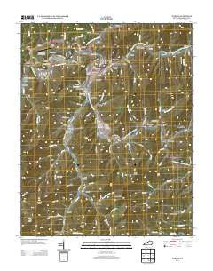
~ Harlan KY topo map, 1:24000 scale, 7.5 X 7.5 Minute, Historical, 2013
Harlan, Kentucky, USGS topographic map dated 2013.
Includes geographic coordinates (latitude and longitude). This topographic map is suitable for hiking, camping, and exploring, or framing it as a wall map.
Printed on-demand using high resolution imagery, on heavy weight and acid free paper, or alternatively on a variety of synthetic materials.
Topos available on paper, Waterproof, Poly, or Tyvek. Usually shipping rolled, unless combined with other folded maps in one order.
- Product Number: USGS-5939635
- Free digital map download (high-resolution, GeoPDF): Harlan, Kentucky (file size: 37 MB)
- Map Size: please refer to the dimensions of the GeoPDF map above
- Weight (paper map): ca. 55 grams
- Map Type: POD USGS Topographic Map
- Map Series: US Topo
- Map Verison: Historical
- Cell ID: 19334
- Datum: North American Datum of 1983
- Map Projection: Transverse Mercator
- Map Cell Name: Harlan
- Grid size: 7.5 X 7.5 Minute
- Date on map: 2013
- Map Scale: 1:24000
- Geographical region: Kentucky, United States
Neighboring Maps:
All neighboring USGS topo maps are available for sale online at a variety of scales.
Spatial coverage:
Topo map Harlan, Kentucky, covers the geographical area associated the following places:
- Three Point - Harlan - Sunshine - Dressen - Gatun - Tin Can Alley (historical) - Mary Helen - Keith - Harlan Gas - Blackjoe - Elcomb - Teetersville - Kitts - Rio Vista - Liggett - Bardo - Fresh Meadows - Chevrolet - Coxton - Lenarue - Clovertown - Yancey - Pansy - Tway - Mary Alice - Baxter - Loyall - Rex - Stanfill - Golden Ash - Farmers Mill
- Map Area ID: AREA36.87536.75-83.375-83.25
- Northwest corner Lat/Long code: USGSNW36.875-83.375
- Northeast corner Lat/Long code: USGSNE36.875-83.25
- Southwest corner Lat/Long code: USGSSW36.75-83.375
- Southeast corner Lat/Long code: USGSSE36.75-83.25
- Northern map edge Latitude: 36.875
- Southern map edge Latitude: 36.75
- Western map edge Longitude: -83.375
- Eastern map edge Longitude: -83.25


