
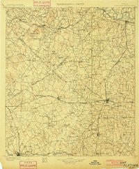
~ Flatonia TX topo map, 1:125000 scale, 30 X 30 Minute, Historical, 1901
Flatonia, Texas, USGS topographic map dated 1901.
Includes geographic coordinates (latitude and longitude). This topographic map is suitable for hiking, camping, and exploring, or framing it as a wall map.
Printed on-demand using high resolution imagery, on heavy weight and acid free paper, or alternatively on a variety of synthetic materials.
Topos available on paper, Waterproof, Poly, or Tyvek. Usually shipping rolled, unless combined with other folded maps in one order.
- Product Number: USGS-5931917
- Free digital map download (high-resolution, GeoPDF): Flatonia, Texas (file size: 9 MB)
- Map Size: please refer to the dimensions of the GeoPDF map above
- Weight (paper map): ca. 55 grams
- Map Type: POD USGS Topographic Map
- Map Series: HTMC
- Map Verison: Historical
- Cell ID: 396101
- Scan ID: 123969
- Survey Year: 1898
- Datum: Unstated
- Map Projection: Unstated
- Map published by United States Geological Survey
- Map Language: English
- Scanner Resolution: 600 dpi
- Map Cell Name: Flatonia
- Grid size: 30 X 30 Minute
- Date on map: 1901
- Map Scale: 1:125000
- Geographical region: Texas, United States
Neighboring Maps:
All neighboring USGS topo maps are available for sale online at a variety of scales.
Spatial coverage:
Topo map Flatonia, Texas, covers the geographical area associated the following places:
- Watterson - Little New York - Komensky - Comanche Crossing - Novohrad - Muldoon - Old Flatonia - Taylorsville - Witting - Bateman - Elm Grove - Salem - Henkhaus - Moulton - Willman - Cistern - Saturn - Waelder - Delhi - Flower Hill - Rosanky - Nickel - Jordan - Praha - Gonzales - Fords Prairie - Elm Grove - Red Rock - String Prairie - Armstrong - Togo - Colorado - Lena - West Point - Marly - Sandy Fork - Kirtley - Hickston - Newtonville - Old Moulton - Floy - Pettytown - Jeddo - Kovar - Rockne - Thompsonville - Flatonia - Saturn - Engle - Dilworth - Brown Hill - Colony - Stellar
- Map Area ID: AREA3029.5-97.5-97
- Northwest corner Lat/Long code: USGSNW30-97.5
- Northeast corner Lat/Long code: USGSNE30-97
- Southwest corner Lat/Long code: USGSSW29.5-97.5
- Southeast corner Lat/Long code: USGSSE29.5-97
- Northern map edge Latitude: 30
- Southern map edge Latitude: 29.5
- Western map edge Longitude: -97.5
- Eastern map edge Longitude: -97


