
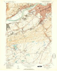
~ Wilkes Barre West PA topo map, 1:24000 scale, 7.5 X 7.5 Minute, Historical, 1950
Wilkes Barre West, Pennsylvania, USGS topographic map dated 1950.
Includes geographic coordinates (latitude and longitude). This topographic map is suitable for hiking, camping, and exploring, or framing it as a wall map.
Printed on-demand using high resolution imagery, on heavy weight and acid free paper, or alternatively on a variety of synthetic materials.
Topos available on paper, Waterproof, Poly, or Tyvek. Usually shipping rolled, unless combined with other folded maps in one order.
- Product Number: USGS-5931809
- Free digital map download (high-resolution, GeoPDF): Wilkes Barre West, Pennsylvania (file size: 14 MB)
- Map Size: please refer to the dimensions of the GeoPDF map above
- Weight (paper map): ca. 55 grams
- Map Type: POD USGS Topographic Map
- Map Series: HTMC
- Map Verison: Historical
- Cell ID: 49106
- Scan ID: 462052
- Aerial Photo Year: 1942
- Field Check Year: 1947
- Datum: NAD27
- Map Projection: Polyconic
- Map published by United States Geological Survey
- Map Language: English
- Scanner Resolution: 600 dpi
- Map Cell Name: Wilkes-Barre West
- Grid size: 7.5 X 7.5 Minute
- Date on map: 1950
- Map Scale: 1:24000
- Geographical region: Pennsylvania, United States
Neighboring Maps:
All neighboring USGS topo maps are available for sale online at a variety of scales.
Spatial coverage:
Topo map Wilkes Barre West, Pennsylvania, covers the geographical area associated the following places:
- Plymouth - Lower Askam - Fairview - Breslau - Blytheburn - Nuangola - Hanover - Newton - Avondale - Nuangola Station - Bliem Corners - Truesdale Terrace - Loomis Park - Solomon Gap - Warrior Run - Hanover Green - Curry Hill - Lee Park - Rule Corners - Plymouth Junction - Ashley - Larksville - Pine View - Lynnwood - Mountain Top - Sugar Notch - Wech Corners - Franklin Junction - Witinski Villa - Fairview Heights - Korn Krest - Dundee - Sickler Hill - Buttonwood - Johnson Greene - Avondale Hill - Askam - Preston - Wilkes-Barre
- Map Area ID: AREA41.2541.125-76-75.875
- Northwest corner Lat/Long code: USGSNW41.25-76
- Northeast corner Lat/Long code: USGSNE41.25-75.875
- Southwest corner Lat/Long code: USGSSW41.125-76
- Southeast corner Lat/Long code: USGSSE41.125-75.875
- Northern map edge Latitude: 41.25
- Southern map edge Latitude: 41.125
- Western map edge Longitude: -76
- Eastern map edge Longitude: -75.875


