
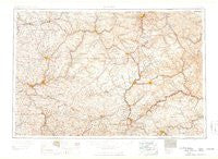
~ Warren PA topo map, 1:250000 scale, 1 X 2 Degree, Historical, 1959
Warren, Pennsylvania, USGS topographic map dated 1959.
Includes geographic coordinates (latitude and longitude). This topographic map is suitable for hiking, camping, and exploring, or framing it as a wall map.
Printed on-demand using high resolution imagery, on heavy weight and acid free paper, or alternatively on a variety of synthetic materials.
Topos available on paper, Waterproof, Poly, or Tyvek. Usually shipping rolled, unless combined with other folded maps in one order.
- Product Number: USGS-5931783
- Free digital map download (high-resolution, GeoPDF): Warren, Pennsylvania (file size: 20 MB)
- Map Size: please refer to the dimensions of the GeoPDF map above
- Weight (paper map): ca. 55 grams
- Map Type: POD USGS Topographic Map
- Map Series: HTMC
- Map Verison: Historical
- Cell ID: 69086
- Scan ID: 462058
- Datum: Unstated
- Map Projection: Transverse Mercator
- Map published by United States Army Corps of Engineers
- Map published by United States Army
- Map Language: English
- Scanner Resolution: 600 dpi
- Map Cell Name: Warren
- Grid size: 1 X 2 Degree
- Date on map: 1959
- Map Scale: 1:250000
- Geographical region: Pennsylvania, United States
Neighboring Maps:
All neighboring USGS topo maps are available for sale online at a variety of scales.
Spatial coverage:
Topo map Warren, Pennsylvania, covers the geographical area associated the following places:
- Canoe Furnace - Rolfe - Anita - Hydetown - Hampton Station - Stanleys Corner - Kahletown - Saint Marys - C and M Junction - Trunkeyville - Higgins Corner - Sawtown - Five Corners - Murrinsville - Allen - Sartwell - Gardner Hill - Carlson - Riceville - Althom - Emerickville - Sarah Furnace - Lafayette - Newmansville - Lamonaville - Hutchins - Galena Hill - Muzette - Ohl - Tait - Corydon (historical) - Clermont - Waterson - Redclyffe - Wolfs Corners - Leonard - Truemans - Dagus - Zion Hill - Wheelock - Riterville - Polk - Plymptonville - Cherry Run - Wesley - Smiths Corners - Winterburn - Horton City - Day - Mount Jewett - Reno - East Wayne - Crystal Springs - Enterprise - Belford - Pottersdale - Hallton - Sackett - Shamburg - Kibbeville - Petroleum Center - Meredith - Iowa - Fryburg - Karthaus - Bradleytown - Caledonia - Rocky Grove - Sykesville - Chaffee - Barkeyville - Grunderville (historical) - Parrish - Grant - Owls Nest - Marvindale - Tapawingo - Middletown - Wildcat - Yellow Hammer - Deckard - Wilcox - Pine Grove - Mina - Lamartine - Green Oaks - Coudley - Clearfield - Annin Creek - Nickleville - Clintonville - Gilmore - Coontown - Daguscahonda - Leatherwood - Oliver Manor - Shaffer - Corry - Little Cooley - Lewis Run
- Map Area ID: AREA4241-80-78
- Northwest corner Lat/Long code: USGSNW42-80
- Northeast corner Lat/Long code: USGSNE42-78
- Southwest corner Lat/Long code: USGSSW41-80
- Southeast corner Lat/Long code: USGSSE41-78
- Northern map edge Latitude: 42
- Southern map edge Latitude: 41
- Western map edge Longitude: -80
- Eastern map edge Longitude: -78


