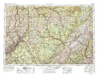
~ Scranton PA topo map, 1:250000 scale, 1 X 2 Degree, Historical, 1962, updated 1977
Scranton, Pennsylvania, USGS topographic map dated 1962.
Includes geographic coordinates (latitude and longitude). This topographic map is suitable for hiking, camping, and exploring, or framing it as a wall map.
Printed on-demand using high resolution imagery, on heavy weight and acid free paper, or alternatively on a variety of synthetic materials.
Topos available on paper, Waterproof, Poly, or Tyvek. Usually shipping rolled, unless combined with other folded maps in one order.
- Product Number: USGS-5931591
- Free digital map download (high-resolution, GeoPDF): Scranton, Pennsylvania (file size: 28 MB)
- Map Size: please refer to the dimensions of the GeoPDF map above
- Weight (paper map): ca. 55 grams
- Map Type: POD USGS Topographic Map
- Map Series: HTMC
- Map Verison: Historical
- Cell ID: 69021
- Scan ID: 461997
- Imprint Year: 1977
- Woodland Tint: Yes
- Visual Version Number: 1
- Aerial Photo Year: 1974
- Edit Year: 1976
- Field Check Year: 1962
- Datum: Unstated
- Map Projection: Transverse Mercator
- Map published by United States Geological Survey
- Map published by: Military, Other
- Map Language: English
- Scanner Resolution: 600 dpi
- Map Cell Name: Scranton
- Grid size: 1 X 2 Degree
- Date on map: 1962
- Map Scale: 1:250000
- Geographical region: Pennsylvania, United States
Neighboring Maps:
All neighboring USGS topo maps are available for sale online at a variety of scales.
Spatial coverage:
Topo map Scranton, Pennsylvania, covers the geographical area associated the following places:
- Autumn Leaves - Lee Park - Sawkill Trailer Park - Siko - Tannery - West Shokan - Echo Lake - Tiffany - Frutchey - Aberdeen - Scranton - Highland Lake Estates - Summit Park - Amity - Harris - Little Britain - Waverly - Pellets Island - Sussex Mills - Sagamore Estates - Kinnebrook Mobile Home Park - Gibson - Odell - Oakland Valley - Mount Prosper - Canterbury Knolls - Allendale - Port Griffith - Wisner - Hillsdale - Hurley - Nebraska - Holiday Pocono - Calno - Quinns Corner - Harriman - Korn Krest - Browns - Woodside - Hamptonburgh - Edwardsville - Glenwood Park - Glen Summit - Lower Askam - Bethany - Holland - The Cape - Barbertown (historical) - Oxford - Neversink - Denniston - Dutch Hollow - Crystal Run - Heart Lake - Scotts Corner - Granite - Wurtsboro Hills - White Lake - Exeter - Highland Lake - Ramsey - Luzerne - North Water Gap - Pringle - Duttonville - Pomona Heights - Upper Greenwood Lake - Nicholson - Oak Grove - Whites Valley - Lower Beechwood - Michigan Corners - Honesdale - Germantown - Wykertown - Airmont - Fernridge - Prospect Hill - Hanover - Conashaugh - Smith Corners - East Side - Ulsterville - Basket - Milanville - Houses Corner - Avoca - Randelville - Harmony Hills - Spring Valley - Sholam - Falls - Methol - Walton Park - Grassy Island - Haags Mill - Monticello - Guymard - Hudson Valley Mobile Home Park - Paradise Crossing
- Map Area ID: AREA4241-76-74
- Northwest corner Lat/Long code: USGSNW42-76
- Northeast corner Lat/Long code: USGSNE42-74
- Southwest corner Lat/Long code: USGSSW41-76
- Southeast corner Lat/Long code: USGSSE41-74
- Northern map edge Latitude: 42
- Southern map edge Latitude: 41
- Western map edge Longitude: -76
- Eastern map edge Longitude: -74

