
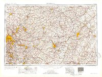
~ Pittsburgh PA topo map, 1:250000 scale, 1 X 2 Degree, Historical, 1954, updated 1954
Pittsburgh, Pennsylvania, USGS topographic map dated 1954.
Includes geographic coordinates (latitude and longitude). This topographic map is suitable for hiking, camping, and exploring, or framing it as a wall map.
Printed on-demand using high resolution imagery, on heavy weight and acid free paper, or alternatively on a variety of synthetic materials.
Topos available on paper, Waterproof, Poly, or Tyvek. Usually shipping rolled, unless combined with other folded maps in one order.
- Product Number: USGS-5931511
- Free digital map download (high-resolution, GeoPDF): Pittsburgh, Pennsylvania (file size: 23 MB)
- Map Size: please refer to the dimensions of the GeoPDF map above
- Weight (paper map): ca. 55 grams
- Map Type: POD USGS Topographic Map
- Map Series: HTMC
- Map Verison: Historical
- Cell ID: 68961
- Scan ID: 461957
- Imprint Year: 1954
- Datum: Unstated
- Map Projection: Transverse Mercator
- Map published by United States Army Corps of Engineers
- Map published by United States Army
- Map Language: English
- Scanner Resolution: 600 dpi
- Map Cell Name: Pittsburgh
- Grid size: 1 X 2 Degree
- Date on map: 1954
- Map Scale: 1:250000
- Geographical region: Pennsylvania, United States
Neighboring Maps:
All neighboring USGS topo maps are available for sale online at a variety of scales.
Spatial coverage:
Topo map Pittsburgh, Pennsylvania, covers the geographical area associated the following places:
- Clinton - Coal Center - Renton Junction - Reitz - Pleasant Valley - Bens Creek - Hickory Hill - Skelp - Johnstown - Oakville - West Brownsville - Ford Cliff - Gosser Hill - Homestead Park - Bowersville - Gratztown - Plumville - Allenport - Cummingswood Park - Casanova - Albany - Ashtola - Long Run - Valemont Heights - Distant - West Lebanon - Juniata - Morann - Eastwood - Klahr - Robbins - Glade Mills - Wesley Chapel - Oakland - Kinter Crossing - Cochrans Mill - Altoona - Echo - Kantner - Pine Top - Adamsburg - Cheswick - Muff - Morewood - Riverton - Salix - Campbells Mill - Wilmerding - Jacktown - Buck Run - Bell Point - Northwood - Crabtree - Shellytown - Bryan Hill Manor - New Homestead - West Point - Arona - Flowing Spring - Hardy - Redbird - Bellwood - Milltown - Unity Junction - Greenwood Village - Verona - Cowansville - Allison Park - Geeseytown - Erhard - Apollo - Strangford - Bretonville - Oakland - Houtzdale - Sunny Side - Spring Mount - Red Hot - Buckeye - Tippecanoe - Belsena - Mount Vernon - Fordham - Utahville - Brick Church - Barners Hill - Chicora - Trauger - Lovely - Leechburg - Elora - Vanderbilt - Allport - Lockview - Cosmus - Bow - Lucket - Dunningtown - Cairnbrook - Rodman
- Map Area ID: AREA4140-80-78
- Northwest corner Lat/Long code: USGSNW41-80
- Northeast corner Lat/Long code: USGSNE41-78
- Southwest corner Lat/Long code: USGSSW40-80
- Southeast corner Lat/Long code: USGSSE40-78
- Northern map edge Latitude: 41
- Southern map edge Latitude: 40
- Western map edge Longitude: -80
- Eastern map edge Longitude: -78


