
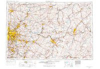
~ Pittsburgh PA topo map, 1:250000 scale, 1 X 2 Degree, Historical, 1958, updated 1971
Pittsburgh, Pennsylvania, USGS topographic map dated 1958.
Includes geographic coordinates (latitude and longitude). This topographic map is suitable for hiking, camping, and exploring, or framing it as a wall map.
Printed on-demand using high resolution imagery, on heavy weight and acid free paper, or alternatively on a variety of synthetic materials.
Topos available on paper, Waterproof, Poly, or Tyvek. Usually shipping rolled, unless combined with other folded maps in one order.
- Product Number: USGS-5931509
- Free digital map download (high-resolution, GeoPDF): Pittsburgh, Pennsylvania (file size: 22 MB)
- Map Size: please refer to the dimensions of the GeoPDF map above
- Weight (paper map): ca. 55 grams
- Map Type: POD USGS Topographic Map
- Map Series: HTMC
- Map Verison: Historical
- Cell ID: 68961
- Scan ID: 461956
- Imprint Year: 1971
- Aerial Photo Year: 1958
- Edit Year: 1969
- Datum: Unstated
- Map Projection: Transverse Mercator
- Map published by United States Geological Survey
- Map Language: English
- Scanner Resolution: 600 dpi
- Map Cell Name: Pittsburgh
- Grid size: 1 X 2 Degree
- Date on map: 1958
- Map Scale: 1:250000
- Geographical region: Pennsylvania, United States
Neighboring Maps:
All neighboring USGS topo maps are available for sale online at a variety of scales.
Spatial coverage:
Topo map Pittsburgh, Pennsylvania, covers the geographical area associated the following places:
- Hastings - Burnside - Husband - Poplar Grove - Kinter Crossing - Hooversville - Walnut Grove - Markle - Brownsdale - Newburg - Gallatin - Cracker Jack - Nealmont - McPherron - Buckeye - Bridgeport - Oak Ridge - Leak Run - Orners Corner - Brentwood - Baldwin Furnace - Tunnelville (historical) - Shieldsburg - Rural Ridge - Edna Number Two - Old Shade Furnace - Carney - Natrona - East Butler - McCrea Furnace - Lover - Rowes Run - Highland - Strongstown - Smeltzer - Bovard - Lynnwood - Vogleyville - Blackburn (historical) - Grandview - Mylo Park - East Run - Dennys Mills - Walter Chapel - Spruce Creek - East Pittsburgh - Woodland - Nanty Glo - Lutzville - Bredinville - Upper Two Lick - Penn Glyn - Cypher - Stoystown - Paradise Furnace - West Moshannon - East Saxton - Enoch - Metcalf - McCormick - Somerset - Barnesboro - Curryville - Muff - Van Buren - Mustard - Irishtown - Linn - Erhard - North Manor - Rico - Norvelt - Cessna - Wells - Oakland - Elfinwild - Laurel Summit - Wissingertown - Gratztown - Central Highlands - Baldwin - Edgewater Terrace - Saluvia - Cotton Town - Haysville - Kimmel - Crete - Avonmore - McKee - Glenwood - Hollentown - Wittmer - Budds Place - Hilldale - Oliveburg - Dunningtown - Penn - Old Stanton - Fairview - Tipton
- Map Area ID: AREA4140-80-78
- Northwest corner Lat/Long code: USGSNW41-80
- Northeast corner Lat/Long code: USGSNE41-78
- Southwest corner Lat/Long code: USGSSW40-80
- Southeast corner Lat/Long code: USGSSE40-78
- Northern map edge Latitude: 41
- Southern map edge Latitude: 40
- Western map edge Longitude: -80
- Eastern map edge Longitude: -78


