
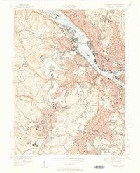
~ Pittsburgh West PA topo map, 1:24000 scale, 7.5 X 7.5 Minute, Historical, 1951
Pittsburgh West, Pennsylvania, USGS topographic map dated 1951.
Includes geographic coordinates (latitude and longitude). This topographic map is suitable for hiking, camping, and exploring, or framing it as a wall map.
Printed on-demand using high resolution imagery, on heavy weight and acid free paper, or alternatively on a variety of synthetic materials.
Topos available on paper, Waterproof, Poly, or Tyvek. Usually shipping rolled, unless combined with other folded maps in one order.
- Product Number: USGS-5931507
- Free digital map download (high-resolution, GeoPDF): Pittsburgh West, Pennsylvania (file size: 15 MB)
- Map Size: please refer to the dimensions of the GeoPDF map above
- Weight (paper map): ca. 55 grams
- Map Type: POD USGS Topographic Map
- Map Series: HTMC
- Map Verison: Historical
- Cell ID: 35477
- Scan ID: 461955
- Survey Year: 1948
- Datum: NAD27
- Map Projection: Polyconic
- Map published by United States Geological Survey
- Map published by United States Army Corps of Engineers
- Map Language: English
- Scanner Resolution: 600 dpi
- Map Cell Name: Pittsburgh West
- Grid size: 7.5 X 7.5 Minute
- Date on map: 1951
- Map Scale: 1:24000
- Geographical region: Pennsylvania, United States
Neighboring Maps:
All neighboring USGS topo maps are available for sale online at a variety of scales.
Spatial coverage:
Topo map Pittsburgh West, Pennsylvania, covers the geographical area associated the following places:
- Woods Run - Ewingsville - Fineview - Bellevue - California Kirkbride - City View - East Carnegie - Banksville - Allegheny Center - Corliss - Chartiers - Duquesne Heights - South Hills - Brookline - Brighton Heights - Kenmawr - Windgap - Beechview - Moon Run - Summer Hill - Elliott - Northview Heights - Green Tree - Dormont - Marshall Shadeland - Downtown - Carnegie - Rook - West End - Perry Hilltop - Pittock - Crafton - Perry North - West Liberty - McKees Rocks - Manchester - Rosslyn Farms - North Shore - Idlewood - Glendale - Mount Washington - West Park - Fairywood - Westwood - Esplen - Heidelberg - Allegheny (historical) - Pennsbury Village - North Side - Thornburg - Woodville - Ingram - Bon Air - Beltzhoover - Edgebrook - Sheraden
- Map Area ID: AREA40.540.375-80.125-80
- Northwest corner Lat/Long code: USGSNW40.5-80.125
- Northeast corner Lat/Long code: USGSNE40.5-80
- Southwest corner Lat/Long code: USGSSW40.375-80.125
- Southeast corner Lat/Long code: USGSSE40.375-80
- Northern map edge Latitude: 40.5
- Southern map edge Latitude: 40.375
- Western map edge Longitude: -80.125
- Eastern map edge Longitude: -80


