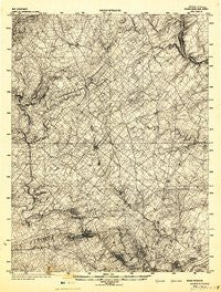
~ Norristown PA topo map, 1:125000 scale, 30 X 30 Minute, Historical, 1942
Norristown, Pennsylvania, USGS topographic map dated 1942.
Includes geographic coordinates (latitude and longitude). This topographic map is suitable for hiking, camping, and exploring, or framing it as a wall map.
Printed on-demand using high resolution imagery, on heavy weight and acid free paper, or alternatively on a variety of synthetic materials.
Topos available on paper, Waterproof, Poly, or Tyvek. Usually shipping rolled, unless combined with other folded maps in one order.
- Product Number: USGS-5931455
- Free digital map download (high-resolution, GeoPDF): Norristown, Pennsylvania (file size: 10 MB)
- Map Size: please refer to the dimensions of the GeoPDF map above
- Weight (paper map): ca. 55 grams
- Map Type: POD USGS Topographic Map
- Map Series: HTMC
- Map Verison: Historical
- Cell ID: 66319
- Scan ID: 461873
- Datum: NAD
- Map Projection: Polyconic
- Map published by United States Army Corps of Engineers
- Map published by United States Army
- Map published by United States Department of War
- Keywords: Nonstandard Press Run
- Map Language: English
- Scanner Resolution: 600 dpi
- Map Cell Name: Philadelphia North
- Grid size: 30 X 30 Minute
- Date on map: 1942
- Map Scale: 1:125000
- Geographical region: Pennsylvania, United States
Neighboring Maps:
All neighboring USGS topo maps are available for sale online at a variety of scales.
Spatial coverage:
Topo map Norristown, Pennsylvania, covers the geographical area associated the following places:
- Narcissa - Birkdale - Southampton - Bob White Farms - Walnut Hill - Wayne - Whitemarsh Hunt - Kimberly Knoll - Rose Valley - Franconia Hunt - Schwenksville - Gwynedd Lea - Meadow View Estates - Buttonwood Farms - Pennbrooke Manor - Tumble Falls - Dartmouth Hills - Valley Greene - Kulpsville - Wismer - Kleinville - Richboro - Yerkes - Townline - Naceville - Helen Marie Court - Edison - Cedar Grove - Paoli Woods Foxwood - Daylesford - Hooverton - Bridle Run - Conshohocken Station - Tioga - Westaway - Brookshyre Woods - Casey Village - McMoran Park - Mount Vernon Gardens - Crestmont - Stormfield - Gulph Mills - Cynwyd - Candle Brook - Stuarts Keep - Arcola - Tacony - Trewigtown - Beidler Knoll - Arbor Glen - Ivyland - Weisel - Orvilla - Hartsville - Noble - East Norriton - Lafayette - Castle Valley - Gwynedd Club - Colmar - Glengary Highlands - Dubarry Estates - Betzwood - Tannerie Woods - Colonial Way - Cathcart Manor - New Galena (historical) - Paoli Gardens - Dresher - Glen Hardie - Fox Heath - Leopard - Shand Vassar - Lexington Park - Manatawna - Belmont Hills - Louxs Corner - Saxony Manor - Providence Knoll - Blackburn Farm - Hickory Tree Estates - Moister Tract - Kingscote - Connaughtown - Lancasterville - Harrow - Huntingdon Valley - Willowburn - Yorkshire Commons - Neshaminy - Shainline - Oak Park - Selsie Village - Greenshire Estates - Squires Knoll - Torresdale - Robert Bruce - The Estates of Audubon South - Norrition Woods - Black Horse
- Map Area ID: AREA40.540-75.5-75
- Northwest corner Lat/Long code: USGSNW40.5-75.5
- Northeast corner Lat/Long code: USGSNE40.5-75
- Southwest corner Lat/Long code: USGSSW40-75.5
- Southeast corner Lat/Long code: USGSSE40-75
- Northern map edge Latitude: 40.5
- Southern map edge Latitude: 40
- Western map edge Longitude: -75.5
- Eastern map edge Longitude: -75

