
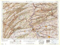
~ Harrisburg PA topo map, 1:250000 scale, 1 X 2 Degree, Historical, 1961, updated 1961
Harrisburg, Pennsylvania, USGS topographic map dated 1961.
Includes geographic coordinates (latitude and longitude). This topographic map is suitable for hiking, camping, and exploring, or framing it as a wall map.
Printed on-demand using high resolution imagery, on heavy weight and acid free paper, or alternatively on a variety of synthetic materials.
Topos available on paper, Waterproof, Poly, or Tyvek. Usually shipping rolled, unless combined with other folded maps in one order.
- Product Number: USGS-5931243
- Free digital map download (high-resolution, GeoPDF): Harrisburg, Pennsylvania (file size: 26 MB)
- Map Size: please refer to the dimensions of the GeoPDF map above
- Weight (paper map): ca. 55 grams
- Map Type: POD USGS Topographic Map
- Map Series: HTMC
- Map Verison: Historical
- Cell ID: 68815
- Scan ID: 461754
- Imprint Year: 1961
- Woodland Tint: Yes
- Visual Version Number: 1
- Field Check Year: 1957
- Datum: Unstated
- Map Projection: Transverse Mercator
- Map published by United States Army Corps of Engineers
- Map published by United States Army
- Map Language: English
- Scanner Resolution: 600 dpi
- Map Cell Name: Harrisburg
- Grid size: 1 X 2 Degree
- Date on map: 1961
- Map Scale: 1:250000
- Geographical region: Pennsylvania, United States
Neighboring Maps:
All neighboring USGS topo maps are available for sale online at a variety of scales.
Spatial coverage:
Topo map Harrisburg, Pennsylvania, covers the geographical area associated the following places:
- Pleasant Hills - Glenn Acres - Vaughn - Colonial Hills - Matterstown - Wolfs Store - Hillsdale Acres - Hauckville - Beacon Lodge - Devonshire Crest - Port Ann - Fort Littleton - Montebello - Roxbury - Vintage - Springville - Dice - Juniata Furnace - Lawrence Park - Oyster Point - Liebys Trailer Park - Doubling Gap - Raubs Mills - Mount Gretna - Millbach - Paxtonville - Centennial Acres - Devonshire Heights - McGovernsville - Powells Valley - McCauley - Dickinson - Rockspring - Craighead - Newtown - Fearnot - Winfield - Wood Ridge Manor - Shermans Dale - Villa Maria Infirmary - Chartwood - Big Spring - Center Square - Northumberland - Sand Hill - Bausman - Bush Addition - Taylorville - Brownstown - Hosensock - Harwood - Fertility - Millport - Stafford Heights - Buffalo Run - Alpine - Penryn - Branch Dale - New Berlin - Oberlin Gardens - Shamokin Dam - Fort Couch - Loschs - Coldsborough Manor - Millersburg - Windsor Manor - Bethel - Snufftown - Mount Wolf - Donnally Mills - Kissimmee - Hopeland - Windom - Lurgan - Vandyke - Spring Run Manor - Peace Church - Cameron - Carlisle Junction - Wertzville - Barrville - Grings Hill Estates - Uniontown - Manchester - Howell - Lewisburg - Coventry Close - Mooresburg - Strong - New Boston - Reinholds - Eden - Concord - Kreamer - Lewisberry - New Holland - Rager Summit - Bridgeport - Kneass - Brushtown
- Map Area ID: AREA4140-78-76
- Northwest corner Lat/Long code: USGSNW41-78
- Northeast corner Lat/Long code: USGSNE41-76
- Southwest corner Lat/Long code: USGSSW40-78
- Southeast corner Lat/Long code: USGSSE40-76
- Northern map edge Latitude: 41
- Southern map edge Latitude: 40
- Western map edge Longitude: -78
- Eastern map edge Longitude: -76


