
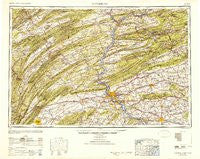
~ Harrisburg PA topo map, 1:250000 scale, 1 X 2 Degree, Historical, 1950, updated 1952
Harrisburg, Pennsylvania, USGS topographic map dated 1950.
Includes geographic coordinates (latitude and longitude). This topographic map is suitable for hiking, camping, and exploring, or framing it as a wall map.
Printed on-demand using high resolution imagery, on heavy weight and acid free paper, or alternatively on a variety of synthetic materials.
Topos available on paper, Waterproof, Poly, or Tyvek. Usually shipping rolled, unless combined with other folded maps in one order.
- Product Number: USGS-5931241
- Free digital map download (high-resolution, GeoPDF): Harrisburg, Pennsylvania (file size: 22 MB)
- Map Size: please refer to the dimensions of the GeoPDF map above
- Weight (paper map): ca. 55 grams
- Map Type: POD USGS Topographic Map
- Map Series: HTMC
- Map Verison: Historical
- Cell ID: 68815
- Scan ID: 461753
- Imprint Year: 1952
- Woodland Tint: Yes
- Aerial Photo Year: 1939
- Datum: NAD27
- Map Projection: Transverse Mercator
- Map published by United States Army Corps of Engineers
- Map published by United States Army
- Map Language: English
- Scanner Resolution: 600 dpi
- Map Cell Name: Harrisburg
- Grid size: 1 X 2 Degree
- Date on map: 1950
- Map Scale: 1:250000
- Geographical region: Pennsylvania, United States
Neighboring Maps:
All neighboring USGS topo maps are available for sale online at a variety of scales.
Spatial coverage:
Topo map Harrisburg, Pennsylvania, covers the geographical area associated the following places:
- East Mahanoy Junction - Silver Spring - Hecla - Wernersville - Spring Dale Heights - Mainville - Big Spring - Julian - Marstown - Knobville - Roseville - Ringtown - Heckton - Fairbrook - White Oak - Allen - Dietrich - Summerdale - Bernville - Dice - Lowell - Colyer - Heckscherville - Starview - Stricklerstown - Mowersville - Windsor Manor - Cornwall Furnace - Danville - Troutwell - Loyalton - Colonial Park - Irishtown - Colonial Wood - Kulps - Sheppton - Rexmont - Kricks Mill - Paxtonville - Fredericksburg - Connerton - Chartwood - Detters Mill - Cedar Hill - Windom - Vulcan - Hamilton - Ellendale Forge - Cove - Aucheys - Inglenook - Barnitz - University Park - Matterstown - Rockford Heights - Rustic Hills - Klingerstown - Lewistown Junction - McGovernsville - Stouchsburg - Rockhill - Kinderhook - Midway - Ridgeland - Fort Indiantown Gap - Hepler - Honey - Centre Hill - Grantville - Chestnut Hill - Mount Zion - Delano - East Salem - Chestnut Hill - Monroe Furnace - Rutherford - Campbelltown - Lorraine - Roundtown - Murray - Holliday - Suedberg - Rockville - Linntown - Monticello - Malta - Bucknell - Greenwood Hills - Mannsville - Mount Hope - Carlisle Junction - Moors Mill - Ridgeville - Berne - Hebe - Mausdale - Hatton - Bird in Hand - Beaverdale - Frystown
- Map Area ID: AREA4140-78-76
- Northwest corner Lat/Long code: USGSNW41-78
- Northeast corner Lat/Long code: USGSNE41-76
- Southwest corner Lat/Long code: USGSSW40-78
- Southeast corner Lat/Long code: USGSSE40-76
- Northern map edge Latitude: 41
- Southern map edge Latitude: 40
- Western map edge Longitude: -78
- Eastern map edge Longitude: -76


