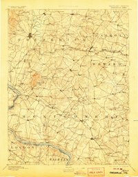
~ Frederick MD topo map, 1:125000 scale, 30 X 30 Minute, Historical, 1894, updated 1906
Frederick, Maryland, USGS topographic map dated 1894.
Includes geographic coordinates (latitude and longitude). This topographic map is suitable for hiking, camping, and exploring, or framing it as a wall map.
Printed on-demand using high resolution imagery, on heavy weight and acid free paper, or alternatively on a variety of synthetic materials.
Topos available on paper, Waterproof, Poly, or Tyvek. Usually shipping rolled, unless combined with other folded maps in one order.
- Product Number: USGS-5930363
- Free digital map download (high-resolution, GeoPDF): Frederick, Maryland (file size: 8 MB)
- Map Size: please refer to the dimensions of the GeoPDF map above
- Weight (paper map): ca. 55 grams
- Map Type: POD USGS Topographic Map
- Map Series: HTMC
- Map Verison: Historical
- Cell ID: 65519
- Scan ID: 461448
- Imprint Year: 1906
- Survey Year: 1889
- Datum: Unstated
- Map Projection: Unstated
- Map published by United States Geological Survey
- Map Language: English
- Scanner Resolution: 600 dpi
- Map Cell Name: Frederick
- Grid size: 30 X 30 Minute
- Date on map: 1894
- Map Scale: 1:125000
- Geographical region: Maryland, United States
Neighboring Maps:
All neighboring USGS topo maps are available for sale online at a variety of scales.
Spatial coverage:
Topo map Frederick, Maryland, covers the geographical area associated the following places:
- Morgan - Quail Creek Acres - Homecrest - Williamsburg Square - Southview - Dotsons Ridge - Sanandrews - Naples Manor - Valley View - Poulsen Heights - Blocktown - Fairhill - Mount Ephraim - Farmbrook - Highland View - Bushey Heights - Rolling Knolls - Willow Ridge - Montgomery Village - Buffalo Hills - Jerusalem - Hanford Estates - Springwood - Smith - Mount Zion Knolls - Mount Pleasant Estates - Burnt Mills - Honey Hill - Quince Orchard Knolls - Running Brook Acres - Rockville - Connecticut Avenue Hills - Taskers Chance - Brookeville Knolls - Hansonville - Ancient Oak - Briars Acres - Gibralter Acres - Damascus View - Dobridge - Holler - Weldon - Glenora Hills - Butterfield - Countryside - Crampton - Browns Corner - McKenney Hills - Barnesville - Darnestown Hills - Tulip Hill - Waterford - Georgetown Village - Charlene - Clifton Knoll - Robin Meadows - The Ponderosa - Renn Branch Estates - Northwood Forest - Old Germantown - Newport Hills - Englandtowne - Eastview - Spring Lake Park - Griffith Park - Pinehurst - Buckeystown Station - Windsong Farms - Potomac Falls - Pleasant Oaks - Linganore Woods - Hipsleys Mill - Brinklow - Winpenny Tell - Greenridge Acres - Burnt Hickory - Make Shift Estates - Cedar Grove Knolls - Cashell Woods - Dulany Hills - Meadowood - Walnut Hill - Hoot'N Hollow - Bloomfield - Windsor Estates - Olde Oak Run - Oak Ridge - Ashton River Estates - Potomac Grove - Ashley Manor - Broadwood Manor - Silver Hill - Keller - Shookstown Heights - Chadwick - Norwood Knolls - Hartman - Culler Oaks - River Wood Hills - Heather Ridge
- Map Area ID: AREA39.539-77.5-77
- Northwest corner Lat/Long code: USGSNW39.5-77.5
- Northeast corner Lat/Long code: USGSNE39.5-77
- Southwest corner Lat/Long code: USGSSW39-77.5
- Southeast corner Lat/Long code: USGSSE39-77
- Northern map edge Latitude: 39.5
- Southern map edge Latitude: 39
- Western map edge Longitude: -77.5
- Eastern map edge Longitude: -77


