
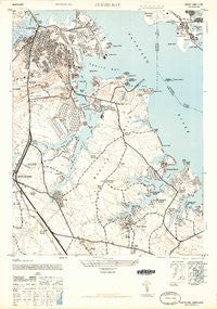
~ Curtis Bay MD topo map, 1:24000 scale, 7.5 X 7.5 Minute, Historical, 1946
Curtis Bay, Maryland, USGS topographic map dated 1946.
Includes geographic coordinates (latitude and longitude). This topographic map is suitable for hiking, camping, and exploring, or framing it as a wall map.
Printed on-demand using high resolution imagery, on heavy weight and acid free paper, or alternatively on a variety of synthetic materials.
Topos available on paper, Waterproof, Poly, or Tyvek. Usually shipping rolled, unless combined with other folded maps in one order.
- Product Number: USGS-5930329
- Free digital map download (high-resolution, GeoPDF): Curtis Bay, Maryland (file size: 10 MB)
- Map Size: please refer to the dimensions of the GeoPDF map above
- Weight (paper map): ca. 55 grams
- Map Type: POD USGS Topographic Map
- Map Series: HTMC
- Map Verison: Historical
- Cell ID: 11074
- Scan ID: 461403
- Aerial Photo Year: 1943
- Field Check Year: 1944
- Datum: NAD27
- Map Projection: Polyconic
- Map published by United States Army
- Map Language: English
- Scanner Resolution: 600 dpi
- Map Cell Name: Curtis Bay
- Grid size: 7.5 X 7.5 Minute
- Date on map: 1946
- Map Scale: 1:24000
- Geographical region: Maryland, United States
Neighboring Maps:
All neighboring USGS topo maps are available for sale online at a variety of scales.
Spatial coverage:
Topo map Curtis Bay, Maryland, covers the geographical area associated the following places:
- Marwood - Marley - Long Hill - Bohemia Beach - Rock Anna - Brooklyn Homes - Stoney View - Point Pleasant - Augusta Acres - East Brooklyn - The Highlands - Arbordale - Water Oak Cove - Howard Manor - Guilford Manor - Acresville - Glen Hollow - Summerfield - Curtis Bay - Sun Valley - Dundee - Sollers Point - Clear Water Beach - Powhatan Beach - Lipins Corner - Old Glory Beach - Harundale - Sharonville - Woodholme - Shannon Forest - Cadillac Homes - Twin Ridge - Riviera Isle - Mount Pleasant Beach - Gerard Plaza - Shannon Square - Furnace Branch - Oakwood Park - Carvel Beach - Sunset Beach - Glenwood - Lombardee Beach - Cottage Grove Beach - Armiger - Fox Chase - Rippling Ridge - Chesterfield Plaza - Solley - Brooklyn Manor - Hillside Park - Towering Oaks - Shoreland - Arundel Gardens - Orchard Beach - Country Club Estates - Dunbrook - Rock Creek Estates - High Point - Masonville - Freetown - Mountain Estates - Lake Riviera - Gatewater - Martindale - Hammarlee - Pine Grove Village - Timber Glade - Rockview Beach - Solley Park - Woodcrest - Greenlawn Beach - Lake View - Villa Tuscana - Sandy Oaks - Arundel Village - Brightwater Beach - Oak Ridge Manor - Willow - Heritage Hill - Elizabeths Landing - Green Haven - Hillcrest - Aspen Park - Oakwood Manor - Turf Valley - Stonehaven - Capitol Hills - Glendale Terrace - Shetland Square - Glenmore - Phyllis Estates - Roland Terrace - Marley Heights - Tydings - Stoneybrook Village - Water Oak Forest - Mansion House Manor - Cromwell Station - Bar Harbor Manor - Morris Hills
- Map Area ID: AREA39.2539.125-76.625-76.5
- Northwest corner Lat/Long code: USGSNW39.25-76.625
- Northeast corner Lat/Long code: USGSNE39.25-76.5
- Southwest corner Lat/Long code: USGSSW39.125-76.625
- Southeast corner Lat/Long code: USGSSE39.125-76.5
- Northern map edge Latitude: 39.25
- Southern map edge Latitude: 39.125
- Western map edge Longitude: -76.625
- Eastern map edge Longitude: -76.5


