
~ Cumberland MD topo map, 1:250000 scale, 1 X 2 Degree, Historical, 1952
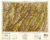
Cumberland, Maryland, USGS topographic map dated 1952.
Includes geographic coordinates (latitude and longitude). This topographic map is suitable for hiking, camping, and exploring, or framing it as a wall map.
Printed on-demand using high resolution imagery, on heavy weight and acid free paper, or alternatively on a variety of synthetic materials.
Topos available on paper, Waterproof, Poly, or Tyvek. Usually shipping rolled, unless combined with other folded maps in one order.
- Product Number: USGS-5930315
- Free digital map download (high-resolution, GeoPDF): Cumberland, Maryland (file size: 23 MB)
- Map Size: please refer to the dimensions of the GeoPDF map above
- Weight (paper map): ca. 55 grams
- Map Type: POD USGS Topographic Map
- Map Series: HTMC
- Map Verison: Historical
- Cell ID: 68734
- Scan ID: 461426
- Woodland Tint: Yes
- Aerial Photo Year: 1944
- Datum: NAD27
- Map Projection: Transverse Mercator
- Map published by United States Army
- Map Language: English
- Scanner Resolution: 600 dpi
- Map Cell Name: Cumberland
- Grid size: 1 X 2 Degree
- Date on map: 1952
- Map Scale: 1:250000
- Geographical region: Maryland, United States
Neighboring Maps:
All neighboring USGS topo maps are available for sale online at a variety of scales.
Spatial coverage:
Topo map Cumberland, Maryland, covers the geographical area associated the following places:
- Woodbridgetown - Mench - Reynolds - Gilmore - Bean Settlement - Thornton - Glencoe - Westwood - Noswad (historical) - Doe Gully - Gorman - Websters Mill - Wolfe Mill - Cedar Cliff - Taylor - Herring - Leith - Woodrow - Short Gap - Sandy Hill (historical) - Cold Stream - Bloom (historical) - Exline - Wiles Hill - Creekvale - Franklin - Stewartstown - New Moatsville (historical) - Canaan Heights - Cather Estates - Rock Oak - Brier Hill - Sprucetown - Newcomer - Stonebrook Farms - Wharton Furnace - Clinton Furnace - Fieldsons Crossroads - Moscow - Martin - Allegany Grove - Humbert - Brotherton - Twiggtown - Philson - Triune - Johnsons Mill - Shenandoah Hills - Pyletown - West Meyersdale - Capon Bridge - Niverton - Mapletown - Grantsville - Knottsville - Donaldson - Gainesboro - Benbush - Hoover - Sand Patch - Boyce - De Haven - Clearville - Cresaptown - West Salisbury - Mount Washington - Plum Run - Lake Lynn - Manheim - Lardin - Harmony Grove - Rawlings - Parkins Mills - Sulphur Springs - Rolling Hills - High View Manor - Jackson Mills - Keeneland - Purcell - Nineveh - Fieldcrest - Glade Farms - Kirby - Canyon - High Point - West Virginia Central Junction - Milford - Fairdale - Jones Springs - Doman (historical) - South Park - Glade - North River Mills - Tyrone - Baker - Fellowsville - Sixmile House - Whetsell (historical) - Streby - Lashley
- Map Area ID: AREA4039-80-78
- Northwest corner Lat/Long code: USGSNW40-80
- Northeast corner Lat/Long code: USGSNE40-78
- Southwest corner Lat/Long code: USGSSW39-80
- Southeast corner Lat/Long code: USGSSE39-78
- Northern map edge Latitude: 40
- Southern map edge Latitude: 39
- Western map edge Longitude: -80
- Eastern map edge Longitude: -78


