
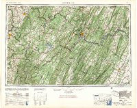
~ Cumberland MD topo map, 1:250000 scale, 1 X 2 Degree, Historical, 1957
Cumberland, Maryland, USGS topographic map dated 1957.
Includes geographic coordinates (latitude and longitude). This topographic map is suitable for hiking, camping, and exploring, or framing it as a wall map.
Printed on-demand using high resolution imagery, on heavy weight and acid free paper, or alternatively on a variety of synthetic materials.
Topos available on paper, Waterproof, Poly, or Tyvek. Usually shipping rolled, unless combined with other folded maps in one order.
- Product Number: USGS-5930313
- Free digital map download (high-resolution, GeoPDF): Cumberland, Maryland (file size: 28 MB)
- Map Size: please refer to the dimensions of the GeoPDF map above
- Weight (paper map): ca. 55 grams
- Map Type: POD USGS Topographic Map
- Map Series: HTMC
- Map Verison: Historical
- Cell ID: 68734
- Scan ID: 461425
- Woodland Tint: Yes
- Aerial Photo Year: 1944
- Datum: NAD27
- Map Projection: Transverse Mercator
- Map published by United States Army Corps of Engineers
- Map published by United States Army
- Map Language: English
- Scanner Resolution: 600 dpi
- Map Cell Name: Cumberland
- Grid size: 1 X 2 Degree
- Date on map: 1957
- Map Scale: 1:250000
- Geographical region: Maryland, United States
Neighboring Maps:
All neighboring USGS topo maps are available for sale online at a variety of scales.
Spatial coverage:
Topo map Cumberland, Maryland, covers the geographical area associated the following places:
- Saint Paul - West Virginia Central Junction - Selbysport - Cardale - Horseshoe Curve - Gannon - Shober - Hoover - Kernstown - Dunlap Creek Village - Lake Frederick - Dawson - Easton - Kaufmann - Twiggtown - The Mileground - Percy - State Line - Independence - Erwin - Hoblitzell - Pleasant Valley - Compton - Brandonville - Beryl - Burning Bush - Puritan - Layside Estates - Beegleton - Russelldale - Clemtown - Yeakle Mill - Indian Springs - Gilmore - Lucas Heights - Rest - Coolspring - Gravel Hill - North Branch - Kessel - Rockwood Station - Cranesville - Riverside - Pleasantdale - Asher Glade - Sir Johns Run - Wiles Hill - Breedlove (historical) - Tarico Heights - Orient - Hoard - Cooks Mills - Laurel Falls - Bloom (historical) - Blaser - Gates - High View - College Park - Irishtown - Streby - Salem - Miller Heights - Springs - Beans Cove - Hendricks - Mount Savage Junction - Dellslow - Rock Oak - Burlington - Green Spring - Fairway Meadows - Dugan Hill - Rolling Hills - Winstead - North Hills - Hudson - Heritage Hills - Nikep - Roberts - Sherwood Forest - Monarch - Carmel - Hilderbrand - Johnsons Mill - Markleton - William - Crosstown - Ritters - Jaco - Paxton Hills - Nineveh - Mineral Spring - Heathers Run - Threefork Bridge - Oliver - Meadowville - Millwood - Clear Ridge - Glassworks - Ridgedale
- Map Area ID: AREA4039-80-78
- Northwest corner Lat/Long code: USGSNW40-80
- Northeast corner Lat/Long code: USGSNE40-78
- Southwest corner Lat/Long code: USGSSW39-80
- Southeast corner Lat/Long code: USGSSE39-78
- Northern map edge Latitude: 40
- Southern map edge Latitude: 39
- Western map edge Longitude: -80
- Eastern map edge Longitude: -78


