
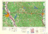
~ Shreveport LA topo map, 1:250000 scale, 1 X 2 Degree, Historical, 1984, updated 1984
Shreveport, Louisiana, USGS topographic map dated 1984.
Includes geographic coordinates (latitude and longitude). This topographic map is suitable for hiking, camping, and exploring, or framing it as a wall map.
Printed on-demand using high resolution imagery, on heavy weight and acid free paper, or alternatively on a variety of synthetic materials.
Topos available on paper, Waterproof, Poly, or Tyvek. Usually shipping rolled, unless combined with other folded maps in one order.
- Product Number: USGS-5930189
- Free digital map download (high-resolution, GeoPDF): Shreveport, Louisiana (file size: 19 MB)
- Map Size: please refer to the dimensions of the GeoPDF map above
- Weight (paper map): ca. 55 grams
- Map Type: POD USGS Topographic Map
- Map Series: HTMC
- Map Verison: Historical
- Cell ID: 69030
- Scan ID: 707611
- Imprint Year: 1984
- Woodland Tint: Yes
- Datum: Unstated
- Map Projection: Transverse Mercator
- Map published by United States Army Corps of Engineers
- Map published by United States Army
- Map Language: English
- Scanner Resolution: 508 dpi
- Map Cell Name: Shreveport
- Grid size: 1 X 2 Degree
- Date on map: 1984
- Map Scale: 1:250000
- Geographical region: Louisiana, United States
Neighboring Maps:
All neighboring USGS topo maps are available for sale online at a variety of scales.
Spatial coverage:
Topo map Shreveport, Louisiana, covers the geographical area associated the following places:
- Fondale - Erco - Sylvan Lake Estates - Carlton - Norton Corner - McKenzie - Brooklyn (historical) - Huntington Park - Dykesville - Bellevue - Port Boliver - Parkwood - Lela - Forest Home - Old Newport (historical) - Forest Park - Meadow Creek Ranch - Suburban North - Myrtis - De Siard - Willow Chute - Dodson - Clifford - Columbia Heights - Normandy Village - Royal Pines - Frog Level (historical) - Lapine - Grayson - Caspiana - Carroll - Wood Springs - Good Roads - Cooktown - Mount Zion - Phillips - Garden Park - Pine Grove - Ebenzer - Oak Hill - Fairway Forest - Harwick Place - Taylortown - Forksville - Swindleville - Woodville - Hill - Fairfield - Old Saline - Moss - Pine Hill Subdivision - Mayers - Carmel - Banks Springs - North Club Estates - Armistead - Sikes - Anderson - Skidder - Kingston - Old Ten - Honore - Vining Mills (historical) - Choudrant - Lucas - Country Place - Shull (historical) - Northwoods - Hebron - Quitman - Aulds (historical) - Shoreline - Sharon - Red Chute - Magnolia - Hudson - Mount Lebanon - Gahagan - Hickory Springs (historical) - Audrey Park - Lachute - Forest Oak - Silver Pine Village - Burgessville (historical) - Goldonna - Breard - Swan Lake - Dopson - Frierson - Wyatt - Mulberry Hill (historical) - Halfway - Roy - Albany (historical) - Goss - Mount Olive - Cross Lake Hills South - Golden Meadows - Hilly - King Forest
- Map Area ID: AREA3332-94-92
- Northwest corner Lat/Long code: USGSNW33-94
- Northeast corner Lat/Long code: USGSNE33-92
- Southwest corner Lat/Long code: USGSSW32-94
- Southeast corner Lat/Long code: USGSSE32-92
- Northern map edge Latitude: 33
- Southern map edge Latitude: 32
- Western map edge Longitude: -94
- Eastern map edge Longitude: -92


