
~ New Orleans LA topo map, 1:250000 scale, 1 X 2 Degree, Historical, 1963
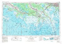
New Orleans, Louisiana, USGS topographic map dated 1963.
Includes geographic coordinates (latitude and longitude). This topographic map is suitable for hiking, camping, and exploring, or framing it as a wall map.
Printed on-demand using high resolution imagery, on heavy weight and acid free paper, or alternatively on a variety of synthetic materials.
Topos available on paper, Waterproof, Poly, or Tyvek. Usually shipping rolled, unless combined with other folded maps in one order.
- Product Number: USGS-5930185
- Free digital map download (high-resolution, GeoPDF): New Orleans, Louisiana (file size: 20 MB)
- Map Size: please refer to the dimensions of the GeoPDF map above
- Weight (paper map): ca. 55 grams
- Map Type: POD USGS Topographic Map
- Map Series: HTMC
- Map Verison: Historical
- Cell ID: 72240
- Scan ID: 707493
- Woodland Tint: Yes
- Aerial Photo Year: 1972
- Edit Year: 1972
- Field Check Year: 1963
- Datum: NAD27
- Map Projection: Transverse Mercator
- Map published by United States Geological Survey
- Map published by: Military, Other
- Map Language: English
- Scanner Resolution: 508 dpi
- Map Cell Name: New Orleans
- Grid size: 1 X 2 Degree
- Date on map: 1963
- Map Scale: 1:250000
- Geographical region: Louisiana, United States
Neighboring Maps:
All neighboring USGS topo maps are available for sale online at a variety of scales.
Spatial coverage:
Topo map New Orleans, Louisiana, covers the geographical area associated the following places:
- Mimosa Park - Laurel Ridge Plantation - Elm Hall - Laurel Grove - Gloria - Concession - Weeks - Morgan City Beach - Little Farms (historical) - Ursa - Violas Mobile Home Park - Remwood Mobile Home Park - Bon Secours Plantation - Glenwood - Edward Daigle - Westwego - Cancienne - Ellerslie - Waterproof - Country Boy Mobile Home Park - Derouen - Golden Meadow - McBride - Caneland - Orange Grove Plantation - Storyville - Bellemeade - Clovelly Farms - Cote Blanche Landing - Gold Mine - Cedar Grove Plantation - Bayou Boeuf - Rex Trailer Court - Allemand - Loisel - Idlewild - River Ridge - Sarah - Mulberry - Belle Amie - Sievers Trailer Court - Ludger - Tabatiere Perdue - Oakshire Manor - Lydia - Gheens - Garden City - Four Corners - Flagville - Oak Ridge Park - Circle G Mobile Home Park - Sorrel - Prevost - Acadian Villa - Supreme - Rosedale - Glencoe - Country Hollow - Point-Aux-Chenes - Delaware - Bayou Sale - Boutte - Fairlane - Metairie Terrace - Humphreys - Midway - Grandbois - Greewood Plantation - Caffery - Brandywine - Lockport Heights - Harvey - Montegut - Boudreaux - Bull Run - Georgia - Chula - Greenwood Acres - Lasalle - Carriage Cove Mobile Home Park - North Bend - Lower Texas - Magnolia - Home Place - Albemarle - Norco - Abby Plantation - Lagan - Berard - Faleau (historical) - Savoie - Woodland Heights Mobile Home Community - Himalaya - Bayou Cane - Santiague - Woodmere - Ollie - Lone Star - Oak Forest - Pesson
- Map Area ID: AREA3029-92-90
- Northwest corner Lat/Long code: USGSNW30-92
- Northeast corner Lat/Long code: USGSNE30-90
- Southwest corner Lat/Long code: USGSSW29-92
- Southeast corner Lat/Long code: USGSSE29-90
- Northern map edge Latitude: 30
- Southern map edge Latitude: 29
- Western map edge Longitude: -92
- Eastern map edge Longitude: -90


