
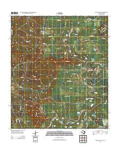
~ Wiergate SE TX topo map, 1:24000 scale, 7.5 X 7.5 Minute, Historical, 2012
Wiergate SE, Texas, USGS topographic map dated 2012.
Includes geographic coordinates (latitude and longitude). This topographic map is suitable for hiking, camping, and exploring, or framing it as a wall map.
Printed on-demand using high resolution imagery, on heavy weight and acid free paper, or alternatively on a variety of synthetic materials.
Topos available on paper, Waterproof, Poly, or Tyvek. Usually shipping rolled, unless combined with other folded maps in one order.
- Product Number: USGS-5928194
- Free digital map download (high-resolution, GeoPDF): Wiergate SE, Texas (file size: 28 MB)
- Map Size: please refer to the dimensions of the GeoPDF map above
- Weight (paper map): ca. 55 grams
- Map Type: POD USGS Topographic Map
- Map Series: US Topo
- Map Verison: Historical
- Cell ID: 48970
- Datum: North American Datum of 1983
- Map Projection: Transverse Mercator
- Map Cell Name: Wiergate SE
- Grid size: 7.5 X 7.5 Minute
- Date on map: 2012
- Map Scale: 1:24000
- Geographical region: Texas, United States
Neighboring Maps:
All neighboring USGS topo maps are available for sale online at a variety of scales.
Spatial coverage:
Topo map Wiergate SE, Texas, covers the geographical area associated the following places:
- Detty Creek - Mill Creek - Palmettos Brake - Gar Lake - Yokum Lake - Indian Creek - Bird Lake - Swain River - Russell Bend - Catfish Lake - Flat Creek - Wood Lake - Huckleberry River - Black Creek - Pine Island - Black Branch - Gray Hammock - Yellow Branch - Sycamore Church - Yellow Lake - Hickman Creek - Corey Branch - Cross Bayou Lake - Scoggins Bend - Bird Lake - Sibo Brake - Smith Lake - Gum Lake - Brack Creek - Gunter Hill - Dark Hammock - Burr Ferry (historical) - Labar Lake - Copeland Lakes - Burr Ferry Bridge - Clear Creek - Joe Lake - Pearl Creek - Brooks Eddy - Hurger Branch - Harvey Branch - Jones Creek - Brushy Lake - Jarrels Ferry Lake - Round Lake - Daycrain Lake - Melton Creek - Burrs Ferry Bridge - Round Lake - Jim River - Hurricane Branch - Black Land Creek - Jones Lake - Duck Lake - Pine Bluff Lake - Forker Creek - Eddie Lake - Old Wing Slough - Burr Cemetery - Horseshoe Lake - Runyon Hills - Red Bank Creek - Evans Brake
- Map Area ID: AREA31.12531-93.625-93.5
- Northwest corner Lat/Long code: USGSNW31.125-93.625
- Northeast corner Lat/Long code: USGSNE31.125-93.5
- Southwest corner Lat/Long code: USGSSW31-93.625
- Southeast corner Lat/Long code: USGSSE31-93.5
- Northern map edge Latitude: 31.125
- Southern map edge Latitude: 31
- Western map edge Longitude: -93.625
- Eastern map edge Longitude: -93.5


