
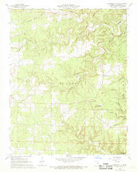
~ Summersville NE MO topo map, 1:24000 scale, 7.5 X 7.5 Minute, Historical, 1968, updated 1969
Summersville NE, Missouri, USGS topographic map dated 1968.
Includes geographic coordinates (latitude and longitude). This topographic map is suitable for hiking, camping, and exploring, or framing it as a wall map.
Printed on-demand using high resolution imagery, on heavy weight and acid free paper, or alternatively on a variety of synthetic materials.
Topos available on paper, Waterproof, Poly, or Tyvek. Usually shipping rolled, unless combined with other folded maps in one order.
- Product Number: USGS-5689450
- Free digital map download (high-resolution, GeoPDF): Summersville NE, Missouri (file size: 12 MB)
- Map Size: please refer to the dimensions of the GeoPDF map above
- Weight (paper map): ca. 55 grams
- Map Type: POD USGS Topographic Map
- Map Series: HTMC
- Map Verison: Historical
- Cell ID: 43732
- Scan ID: 324265
- Imprint Year: 1969
- Woodland Tint: Yes
- Aerial Photo Year: 1966
- Field Check Year: 1968
- Datum: NAD27
- Map Projection: Polyconic
- Map published by United States Geological Survey
- Map Language: English
- Scanner Resolution: 600 dpi
- Map Cell Name: Summersville NE
- Grid size: 7.5 X 7.5 Minute
- Date on map: 1968
- Map Scale: 1:24000
- Geographical region: Missouri, United States
Neighboring Maps:
All neighboring USGS topo maps are available for sale online at a variety of scales.
Spatial coverage:
Topo map Summersville NE, Missouri, covers the geographical area associated the following places:
- Black Valley - Wildwood School (historical) - Flat Rock State Wildlife Area - Casto Valley - Helms School (historical) - Flat Rock Church (historical) - Wolf Hollow - Township of Spring Valley - Black Valley Creek - Hawk Hollow - Black Pond Cemetery - Barnes Hollow - Cave Spring - Standing Rock Hollow - Flat Rock School (historical) - Casto Valley Creek - Pyrtle Hollow - Forty Acre Sinkhole - Rock Lookout Tower - Pipestem Hollow - Flat Rock Church - Black Pond School - Randolph School
- Map Area ID: AREA37.2537.125-91.625-91.5
- Northwest corner Lat/Long code: USGSNW37.25-91.625
- Northeast corner Lat/Long code: USGSNE37.25-91.5
- Southwest corner Lat/Long code: USGSSW37.125-91.625
- Southeast corner Lat/Long code: USGSSE37.125-91.5
- Northern map edge Latitude: 37.25
- Southern map edge Latitude: 37.125
- Western map edge Longitude: -91.625
- Eastern map edge Longitude: -91.5


