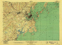
~ Portland And Vicinity ME topo map, 1:62500 scale, 15 X 15 Minute, Historical, 1918, updated 1926
Portland And Vicinity, Maine, USGS topographic map dated 1918.
Includes geographic coordinates (latitude and longitude). This topographic map is suitable for hiking, camping, and exploring, or framing it as a wall map.
Printed on-demand using high resolution imagery, on heavy weight and acid free paper, or alternatively on a variety of synthetic materials.
Topos available on paper, Waterproof, Poly, or Tyvek. Usually shipping rolled, unless combined with other folded maps in one order.
- Product Number: USGS-5689388
- Free digital map download (high-resolution, GeoPDF): Portland And Vicinity, Maine (file size: 12 MB)
- Map Size: please refer to the dimensions of the GeoPDF map above
- Weight (paper map): ca. 55 grams
- Map Type: POD USGS Topographic Map
- Map Series: HTMC
- Map Verison: Historical
- Cell ID: 396029
- Scan ID: 807608
- Imprint Year: 1926
- Woodland Tint: Yes
- Survey Year: 1912
- Datum: Unstated
- Map Projection: Unstated
- Map published by United States Geological Survey
- Map published by United States Army Corps of Engineers
- Map Language: English
- Scanner Resolution: 508 dpi
- Map Cell Name: Portland And Vicinity
- Grid size: 15 X 15 Minute
- Date on map: 1918
- Map Scale: 1:62500
- Geographical region: Maine, United States
Neighboring Maps:
All neighboring USGS topo maps are available for sale online at a variety of scales.
Spatial coverage:
Topo map Portland And Vicinity, Maine, covers the geographical area associated the following places:
- Cliff Island - Village of Halidon (historical) - Trefethen - Grubb Hill (historical) - Woodfords - Saco - Prouts Neck - Little Falls - Loveitts Field - South Harpswell - South Gorham - Delano Park - York Landing - South Buxton - Brighton Corner - Doughty Landing - Munjoy Hill - Rigby (historical) - Eight Corners - Portland - Scarborough - South Portland - Waites Landing - Jones Wharf - Nasons Corner - Broadview Park - Morrills Corner - Milliken Mills - Blue Point - Sandy Brook - Sunset Park - Stroudwater - East End - Little Diamond Island Landing - West Gorham - Mariner - Babb Corner - Boothbay Park - Prides Corner - Ocean Park - Cumberland Mills - Fort Scammel - Falmouth - Peaks Island - Garrison Hills Estates - McKinley Estates - Cleaves Landing - Deering Junction - Town Landing - Pine Park - Oakdale - Riverton - Rosemont - Lunts Corner - Mosher Corner - Chebeague Island - Lone Creek Village (historical) - Knightville - Evergreen Landing - Mountainview Park - Fort Lyon - Surfside - North Scarborough - Fort Levett - Ligonia - Danish Village (historical) - Central Landing - Summit View Park (historical) - Cliff Island Landing - Ferry Village - South Windham - Oak Hill - Meeting House Hill - Gorham - Cushing Island - Deering - Libbytown - North Deering - South Portland Gardens - West Falmouth (historical) - Dunegrass Golf Community - Pleasantdale - Crocketts Corner - Sagamore Village - Cape Cottage - Thornton Heights - East Deering - Highland Lake - Western Landing - Cash Corner - Ponce Landing - Cape Elizabeth - Westbrook - Pine Point - Pine Point Beach - Great Diamond Island Landing - Chandler Cove Landing - Falmouth Foreside - Bradleys Corner - Pleasant Hill
- Map Area ID: AREA43.7543.5-70.5-70
- Northwest corner Lat/Long code: USGSNW43.75-70.5
- Northeast corner Lat/Long code: USGSNE43.75-70
- Southwest corner Lat/Long code: USGSSW43.5-70.5
- Southeast corner Lat/Long code: USGSSE43.5-70
- Northern map edge Latitude: 43.75
- Southern map edge Latitude: 43.5
- Western map edge Longitude: -70.5
- Eastern map edge Longitude: -70

