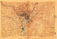
~ Washington MD topo map, 1:62500 scale, 15 X 15 Minute, Historical, 1900, updated 1909
Washington, Maryland, USGS topographic map dated 1900.
Includes geographic coordinates (latitude and longitude). This topographic map is suitable for hiking, camping, and exploring, or framing it as a wall map.
Printed on-demand using high resolution imagery, on heavy weight and acid free paper, or alternatively on a variety of synthetic materials.
Topos available on paper, Waterproof, Poly, or Tyvek. Usually shipping rolled, unless combined with other folded maps in one order.
- Product Number: USGS-5689368
- Free digital map download (high-resolution, GeoPDF): Washington, Maryland (file size: 19 MB)
- Map Size: please refer to the dimensions of the GeoPDF map above
- Weight (paper map): ca. 55 grams
- Map Type: POD USGS Topographic Map
- Map Series: HTMC
- Map Verison: Historical
- Cell ID: 396030
- Scan ID: 255901
- Imprint Year: 1909
- Survey Year: 1897
- Datum: Unstated
- Map Projection: Unstated
- Map published by United States Geological Survey
- Keywords: Overedge
- Map Language: English
- Scanner Resolution: 600 dpi
- Map Cell Name: Washington
- Grid size: 15 X 15 Minute
- Date on map: 1900
- Map Scale: 1:62500
- Geographical region: Maryland, United States
Neighboring Maps:
All neighboring USGS topo maps are available for sale online at a variety of scales.
Spatial coverage:
Topo map Washington, Maryland, covers the geographical area associated the following places:
- Cropley - Windsor Estates - Jefferson - West Over View - Reno - Halls Hill - Clinton Heights - Woodmore - Cabin John - Rolling View - Meadows - Monticello Park - Garden City - Berkshire - Twining - Norbourne Mobile Home Park - Little Washington - North Takoma Park - Columbia Park - Farragut Square - Chillum Heights - Springfield - Brookville - Radnor Heights - Martins Additions - Kerby Hill - Yorkshire Knolls - Berkshire - Blair Portal - White Oaks - College Heights Estates - Burleith - Chesterbrook - North Potomac Vista - Washington Highlands - Woodburn - Rogers Heights - Congress Heights - Widowsville (historical) - Lincoln Park - Fairgreen - Lewinsville Heights - Woodhaven - Courtland Park - Southwest - Parkglen - Dominion Hills - East Central - Kenwood - Berwyn Heights - Arlington Forest - Westmoreland Hills - Fairmount Heights - New Carrollton - Mount Vernon Square - Pinecrest - Winslow Hills - Peppermill Village - Ridgeview - Battery Park - Senate Heights - Huntington - Old Courthouse - Barcroft Woods - Westgate - Embassy Park - Fair Haven - Ritchie - Belle Haven - Chevy Chase Manor - Claremont - Morris Addition (historical) - College Park - Branchville - Sligo Park Hills - West Riverdale - Westview Hills - Alexandria - Stratford Hills - Alpine - Ash Grove - Suitland - Windy Oaks - Woods Corner - Browns Corner - East End - Kettering - Brinetown (historical) - Yates Village - Carsondale - Brown - Cedar Crest - Glenarden - Monticello Woods - Memorial Heights - Bellemead - Sutton Place - Odricks Corner - Royale Gardens - Bannockburn Heights
- Map Area ID: AREA3938.75-77.25-76.75
- Northwest corner Lat/Long code: USGSNW39-77.25
- Northeast corner Lat/Long code: USGSNE39-76.75
- Southwest corner Lat/Long code: USGSSW38.75-77.25
- Southeast corner Lat/Long code: USGSSE38.75-76.75
- Northern map edge Latitude: 39
- Southern map edge Latitude: 38.75
- Western map edge Longitude: -77.25
- Eastern map edge Longitude: -76.75


