
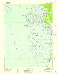
~ Withlacoochee Bay FL topo map, 1:24000 scale, 7.5 X 7.5 Minute, Historical, 1955, updated 1956
Withlacoochee Bay, Florida, USGS topographic map dated 1955.
Includes geographic coordinates (latitude and longitude). This topographic map is suitable for hiking, camping, and exploring, or framing it as a wall map.
Printed on-demand using high resolution imagery, on heavy weight and acid free paper, or alternatively on a variety of synthetic materials.
Topos available on paper, Waterproof, Poly, or Tyvek. Usually shipping rolled, unless combined with other folded maps in one order.
- Product Number: USGS-5689184
- Free digital map download (high-resolution, GeoPDF): Withlacoochee Bay, Florida (file size: 9 MB)
- Map Size: please refer to the dimensions of the GeoPDF map above
- Weight (paper map): ca. 55 grams
- Map Type: POD USGS Topographic Map
- Map Series: HTMC
- Map Verison: Historical
- Cell ID: 72095
- Scan ID: 349152
- Imprint Year: 1956
- Woodland Tint: Yes
- Aerial Photo Year: 1951
- Survey Year: 1955
- Datum: NAD27
- Map Projection: Polyconic
- Map published by United States Geological Survey
- Keywords: Overedge with No Adjacent Map
- Map Language: English
- Scanner Resolution: 600 dpi
- Map Cell Name: Withlacoochee Bay
- Grid size: 7.5 X 7.5 Minute
- Date on map: 1955
- Map Scale: 1:24000
- Geographical region: Florida, United States
Neighboring Maps:
All neighboring USGS topo maps are available for sale online at a variety of scales.
Spatial coverage:
Topo map Withlacoochee Bay, Florida, covers the geographical area associated the following places:
- Richard Creek - Helverson Creek - Turtle Creek - Vassey Creek - Waccasassa Reefs - Bird Creek - Kelly Creek - Grassy Creek - Jubb Island - Roach Island - Turtle Creek Point - Bushstake Gap - Pitts Camp - Eleven Prong - Withlacoochee Reefs - Town of Yankeetown - Fuller Creek - Covas Creek - Lows Bay - South Mangrove Point - Turtle Creek Bay - Thousandmile Creek - Demory Creek - Hodges Island - Withlacoochee Bay - Spring Run - Pumpkin Island - TFD Camp - Smith Creek - Trout Creek - Porpoise Point - MacDonald Creek - Bird Rock - Jones Creek - Lows Creek - Tooke Creek - Bird Island
- Map Area ID: AREA29.12529-82.875-82.75
- Northwest corner Lat/Long code: USGSNW29.125-82.875
- Northeast corner Lat/Long code: USGSNE29.125-82.75
- Southwest corner Lat/Long code: USGSSW29-82.875
- Southeast corner Lat/Long code: USGSSE29-82.75
- Northern map edge Latitude: 29.125
- Southern map edge Latitude: 29
- Western map edge Longitude: -82.875
- Eastern map edge Longitude: -82.75


