
~ New Smyrna Beach FL topo map, 1:24000 scale, 7.5 X 7.5 Minute, Historical, 1956, updated 1993
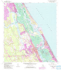
New Smyrna Beach, Florida, USGS topographic map dated 1956.
Includes geographic coordinates (latitude and longitude). This topographic map is suitable for hiking, camping, and exploring, or framing it as a wall map.
Printed on-demand using high resolution imagery, on heavy weight and acid free paper, or alternatively on a variety of synthetic materials.
Topos available on paper, Waterproof, Poly, or Tyvek. Usually shipping rolled, unless combined with other folded maps in one order.
- Product Number: USGS-5689100
- Free digital map download (high-resolution, GeoPDF): New Smyrna Beach, Florida (file size: 17 MB)
- Map Size: please refer to the dimensions of the GeoPDF map above
- Weight (paper map): ca. 55 grams
- Map Type: POD USGS Topographic Map
- Map Series: HTMC
- Map Verison: Historical
- Cell ID: 31856
- Scan ID: 347655
- Imprint Year: 1993
- Woodland Tint: Yes
- Photo Revision Year: 1993
- Aerial Photo Year: 1989
- Edit Year: 1993
- Field Check Year: 1956
- Survey Year: 1952
- Datum: NAD27
- Map Projection: Transverse Mercator
- Map published by United States Geological Survey
- Keywords: Overedge with No Adjacent Map
- Map Language: English
- Scanner Resolution: 600 dpi
- Map Cell Name: New Smyrna Beach
- Grid size: 7.5 X 7.5 Minute
- Date on map: 1956
- Map Scale: 1:24000
- Geographical region: Florida, United States
Neighboring Maps:
All neighboring USGS topo maps are available for sale online at a variety of scales.
Spatial coverage:
Topo map New Smyrna Beach, Florida, covers the geographical area associated the following places:
- Briarwood Mobile Estates - Sugar Mill Ruins Travel Park - Sugar Mill Mobile Home Park - Bayview Trailer Park - Allandale Mobile Home Park - Lutz Mobile Home Park - Riverside Mobile Home Park - Ponce Park - Palm Shores Mobile Home Park - Ponce Inlet - Maplewood Mobile Estates - Isleboro - Live Oak Mobile Village - Shrocks Trailer Park - White Bird Mobile Home Park - New Smyrna (historical) - Seahorse Mobile Home Park - Glencoe - Sugar Mill Estates - Rose Bay Trailer Park - Redland Estates Mobile Home Community - Ocean Aire Estates Mobile Home Park - New Smyrna Beach - Mission City - Treasure Isle Estates Mobile Home Park - Parkwood Manufactured Home Community - Cozy Trailer Park - Harbor Oaks Trailer Park - Allandale - Quail Hollow Mobile Home Park - Harbor Oaks - Gold Rock Park Mobile Home Park
- Map Area ID: AREA29.12529-81-80.875
- Northwest corner Lat/Long code: USGSNW29.125-81
- Northeast corner Lat/Long code: USGSNE29.125-80.875
- Southwest corner Lat/Long code: USGSSW29-81
- Southeast corner Lat/Long code: USGSSE29-80.875
- Northern map edge Latitude: 29.125
- Southern map edge Latitude: 29
- Western map edge Longitude: -81
- Eastern map edge Longitude: -80.875


