
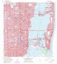
~ Miami FL topo map, 1:24000 scale, 7.5 X 7.5 Minute, Historical, 1962, updated 1977
Miami, Florida, USGS topographic map dated 1962.
Includes geographic coordinates (latitude and longitude). This topographic map is suitable for hiking, camping, and exploring, or framing it as a wall map.
Printed on-demand using high resolution imagery, on heavy weight and acid free paper, or alternatively on a variety of synthetic materials.
Topos available on paper, Waterproof, Poly, or Tyvek. Usually shipping rolled, unless combined with other folded maps in one order.
- Product Number: USGS-5689094
- Free digital map download (high-resolution, GeoPDF): Miami, Florida (file size: 23 MB)
- Map Size: please refer to the dimensions of the GeoPDF map above
- Weight (paper map): ca. 55 grams
- Map Type: POD USGS Topographic Map
- Map Series: HTMC
- Map Verison: Historical
- Cell ID: 29024
- Scan ID: 347462
- Imprint Year: 1977
- Woodland Tint: Yes
- Photo Revision Year: 1969
- Aerial Photo Year: 1969
- Field Check Year: 1962
- Survey Year: 1945
- Datum: NAD27
- Map Projection: Polyconic
- Map published by United States Geological Survey
- Keywords: Overedge with No Adjacent Map
- Map Language: English
- Scanner Resolution: 600 dpi
- Map Cell Name: Miami
- Grid size: 7.5 X 7.5 Minute
- Date on map: 1962
- Map Scale: 1:24000
- Geographical region: Florida, United States
Neighboring Maps:
All neighboring USGS topo maps are available for sale online at a variety of scales.
Spatial coverage:
Topo map Miami, Florida, covers the geographical area associated the following places:
- Northwest Trailer Park - Bayshore - Biscayne Park Mobile Home Park - Edison Center - Sunny South Trailer Park - Avocado Trailer Park - Silver Court Trailer Park - River Park Trailer Park - The Roads - Magic City Trailer Park - Miami Shores - Westland Mobile Home Park - River Park Trailer Park - Little River M and M Mobile Home Park - Gladeview - Normandy Shores - Pinewood - Miami - El Portal - Glenwood Heights - Fisher Island - Parkside Mobile Home Park - Brickell Hammock - J Bar J Trailer Ranch - Shenandoah - Pinewood Park - Trailer Grove Mobile Home Park - Colonial Acres Mobile Home Park - Little Farm Mobile Court - Keystone Tourist Court - Latin Quarter - Paradise Trailer Park - Rovell Mobile Home Park - Isle of Normandy - Allapattah - West Little River - Keystone Mobile Home Park - Buena Vista - Brownsville - All Star 36 Street Mobile Home Park - Port of Miami - Tropical Trailer Village - New Tradewinds Trailer Park - Trinidad Court Mobile Home Park - Paradise Trailer Park - Miami Beach - North Bay Village - Bobs Mobile Home Park - J Bar J Trailer Ranch - Schmidts Adult Mobile Home Park - New Avocado Trailer Park - Lemon City - Little River - Tradewinds Trailer Park - Royal Duke Trailer Court - Liberty Square - Little Farm Mobile Court - Magic City Trailer Park - Palm Lake Mobile Home Park - Little Havana - Palm Lake Trailer Court - Silver Court Trailer Park - Hibiscus Point Mobile Home Park
- Map Area ID: AREA25.87525.75-80.25-80.125
- Northwest corner Lat/Long code: USGSNW25.875-80.25
- Northeast corner Lat/Long code: USGSNE25.875-80.125
- Southwest corner Lat/Long code: USGSSW25.75-80.25
- Southeast corner Lat/Long code: USGSSE25.75-80.125
- Northern map edge Latitude: 25.875
- Southern map edge Latitude: 25.75
- Western map edge Longitude: -80.25
- Eastern map edge Longitude: -80.125


