
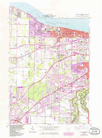
~ North Olmsted OH topo map, 1:24000 scale, 7.5 X 7.5 Minute, Historical, 1963, updated 1985
North Olmsted, Ohio, USGS topographic map dated 1963.
Includes geographic coordinates (latitude and longitude). This topographic map is suitable for hiking, camping, and exploring, or framing it as a wall map.
Printed on-demand using high resolution imagery, on heavy weight and acid free paper, or alternatively on a variety of synthetic materials.
Topos available on paper, Waterproof, Poly, or Tyvek. Usually shipping rolled, unless combined with other folded maps in one order.
- Product Number: USGS-5686333
- Free digital map download (high-resolution, GeoPDF): North Olmsted, Ohio (file size: 14 MB)
- Map Size: please refer to the dimensions of the GeoPDF map above
- Weight (paper map): ca. 55 grams
- Map Type: POD USGS Topographic Map
- Map Series: HTMC
- Map Verison: Historical
- Cell ID: 32435
- Scan ID: 227979
- Imprint Year: 1985
- Woodland Tint: Yes
- Photo Revision Year: 1985
- Aerial Photo Year: 1982
- Edit Year: 1985
- Field Check Year: 1963
- Survey Year: 1953
- Datum: NAD27
- Map Projection: Polyconic
- Map published by United States Geological Survey
- Keywords: Overedge with No Adjacent Map
- Map Language: English
- Scanner Resolution: 600 dpi
- Map Cell Name: North Olmsted
- Grid size: 7.5 X 7.5 Minute
- Date on map: 1963
- Map Scale: 1:24000
- Geographical region: Ohio, United States
Neighboring Maps:
All neighboring USGS topo maps are available for sale online at a variety of scales.
Spatial coverage:
Topo map North Olmsted, Ohio, covers the geographical area associated the following places:
- Cobblestone Chase - The Estates - Farmington Place - Carriage Park Estates - Courtland Meadows - Hidden Acres - Olmsted - Prestwick Glen - Pine Ridge Mobile Home Park - Westhill Estates - Pebblebrook - Columbia Park - Royal Woods - Meadow Lane - Mallard Cove - Dover Bay Estates - Bement - Royal Forest - Westwood Acres - Lake Forest - Devonshire - Forest Park - Lands End - Ashford Estates - Westlake - Rockport Subdivision - West Glen - Bretton Woods - West Park Ridge Estates - Sterling Ridge - Kerrington Estates - Capel Vale - Queens Court - Chairmans Rowe - Sailors Landing - Pineview - Quail Hollow - Bent Tree - Canterbury Colony - Doverwood Estates - Victoria Estates - Cotswold Manor - Balmoral - Hilliard Woods Estates - North Glen Estates - Ohio Shores - Olmsted Falls - Hedgewood - Country Club Estates - Bradley Acres - Melrose - Creekwood Meadows - Canterbury Manor - Breckenridge - Grayton - Windsor Park - Circlewood - Hilliard Oak Estates - Sandy Ridge - Point West - Roseland - The Glens - Fox Chase - Parkland - Prestwick - North Olmsted - Glenmore Estates - Eagle Cliff - Stonehedge - West Ridge - Berkeley - Brigadoon - Rosewood Estates - Rustic Woods - Bay Village - Gibsons Mobile Home Park - Bradley Woods - West Dover - Porter Road Tracks - Canterbury Estates - Woods Of Westlake - Saint Ives - Avalon Estates - Bel Aire Estates - North Dover - Twin Oaks
- Map Area ID: AREA41.541.375-82-81.875
- Northwest corner Lat/Long code: USGSNW41.5-82
- Northeast corner Lat/Long code: USGSNE41.5-81.875
- Southwest corner Lat/Long code: USGSSW41.375-82
- Southeast corner Lat/Long code: USGSSE41.375-81.875
- Northern map edge Latitude: 41.5
- Southern map edge Latitude: 41.375
- Western map edge Longitude: -82
- Eastern map edge Longitude: -81.875


