
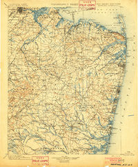
~ Navesink NJ topo map, 1:125000 scale, 30 X 30 Minute, Historical, 1902
Navesink, New Jersey, USGS topographic map dated 1902.
Includes geographic coordinates (latitude and longitude). This topographic map is suitable for hiking, camping, and exploring, or framing it as a wall map.
Printed on-demand using high resolution imagery, on heavy weight and acid free paper, or alternatively on a variety of synthetic materials.
Topos available on paper, Waterproof, Poly, or Tyvek. Usually shipping rolled, unless combined with other folded maps in one order.
- Product Number: USGS-5685951
- Free digital map download (high-resolution, GeoPDF): Navesink, New Jersey (file size: 10 MB)
- Map Size: please refer to the dimensions of the GeoPDF map above
- Weight (paper map): ca. 55 grams
- Map Type: POD USGS Topographic Map
- Map Series: HTMC
- Map Verison: Historical
- Cell ID: 66162
- Scan ID: 255438
- Survey Year: 1885
- Datum: Unstated
- Map Projection: Unstated
- Map published by United States Geological Survey
- Keywords: Overedge with No Adjacent Map
- Map Language: English
- Scanner Resolution: 600 dpi
- Map Cell Name: Navesink
- Grid size: 30 X 30 Minute
- Date on map: 1902
- Map Scale: 1:125000
- Geographical region: New Jersey, United States
Neighboring Maps:
All neighboring USGS topo maps are available for sale online at a variety of scales.
Spatial coverage:
Topo map Navesink, New Jersey, covers the geographical area associated the following places:
- Bradley Beach - Hoffman - Jerseyville - Phalanx - Spotswood - Holmeson - Helmetta - Adamston - Sea Girt - Eatontown - Sayre Woods - Parlin - Smithburg - South Mantoloking Beach - Salem Hill - Robertsville - Thomas J Dohany Homes - Navesink - Sayerwood South - Smocks Corners - Edgewood Park - Freewood Acres - Twin Rivers - Mantoloking - Holmdel - Bergen Mills - Redshaw Corner - Carmerville - Keyport - Matawan - Gillilandtown - Oak Hill - Herberts - Englishtown - Edgemere Estates - Ramtown - West Belmar - Port-au-Peck - Wyckoff Mills - Jamesburg Gardens - Little Silver Point - Manasquan Park - New Brunswick - Breton Woods - Holmansville - Cedar Bridge - Elys Corner - Greensand - New Monmouth - West Deal - Maxim - Farmingdale - Clarks Mills - North Middletown - Leonardville - Mandalay - Woodair Estates - Red Lion - Deal Park - Piscataway - Chestnut Estates - Leisure Village West - Patricks Corners - Martins Landing - Collingwood Park - Cottageville - Tracy - South Amboy - Somerset - Lawrence Brook Manor - Fairview Knolls - East Freehold - Remsen Mill - Mechanicsville - Brielle - Osbornes Mills - New Bedford - Vanderburg - Milltown - Wanamassa - Morganville - Cranbury Station - Bay Head - North Centerville - Greenville - Pleasant Valley - Bairdsville - Lake Riviera - Belford - Oakhurst Manor - West Shrewsbury - Matchaponix - East Keansburg - Cherry Quay - Port Monmouth - Parkway Pines - Adams - A Country Place - Allenhurst - Moerls Corner
- Map Area ID: AREA40.540-74.5-74
- Northwest corner Lat/Long code: USGSNW40.5-74.5
- Northeast corner Lat/Long code: USGSNE40.5-74
- Southwest corner Lat/Long code: USGSSW40-74.5
- Southeast corner Lat/Long code: USGSSE40-74
- Northern map edge Latitude: 40.5
- Southern map edge Latitude: 40
- Western map edge Longitude: -74.5
- Eastern map edge Longitude: -74


