
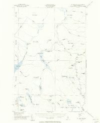
~ St John Pond ME topo map, 1:62500 scale, 15 X 15 Minute, Historical, 1954, updated 1956
St John Pond, Maine, USGS topographic map dated 1954.
Includes geographic coordinates (latitude and longitude). This topographic map is suitable for hiking, camping, and exploring, or framing it as a wall map.
Printed on-demand using high resolution imagery, on heavy weight and acid free paper, or alternatively on a variety of synthetic materials.
Topos available on paper, Waterproof, Poly, or Tyvek. Usually shipping rolled, unless combined with other folded maps in one order.
- Product Number: USGS-5685245
- Free digital map download (high-resolution, GeoPDF): St John Pond, Maine (file size: 5 MB)
- Map Size: please refer to the dimensions of the GeoPDF map above
- Weight (paper map): ca. 55 grams
- Map Type: POD USGS Topographic Map
- Map Series: HTMC
- Map Verison: Historical
- Cell ID: 61944
- Scan ID: 460919
- Imprint Year: 1956
- Aerial Photo Year: 1948
- Field Check Year: 1954
- Datum: NAD27
- Map Projection: Polyconic
- Map published by United States Geological Survey
- Map published by United States Army Corps of Engineers
- Map published by United States Army
- Map Language: English
- Scanner Resolution: 600 dpi
- Map Cell Name: Saint John Pond
- Grid size: 15 X 15 Minute
- Date on map: 1954
- Map Scale: 1:62500
- Geographical region: Maine, United States
Neighboring Maps:
All neighboring USGS topo maps are available for sale online at a variety of scales.
Spatial coverage:
Topo map St John Pond, Maine, covers the geographical area associated the following places:
- Horse Pond - Unorganized Territory of Seboomook Lake - Truesdale Mountain - Lower Dam - Little Bog - Mucalsea Mountain - Lard Pond - Russell Mountain - Third Saint John Pond - Austin Pond - Elm Pond Mountain - Turner Brook - Little Elm Pond - Saddle Brook - Nulhedus Mountain - Saint John Pond Depot - Sheehan Brook - Upper First Saint John Pond - Little Russell Mountain - Beaver Brook - Austin Brook - Lost Pond Brook - McDonald Brook - Trout Brook - Reed Brook - Gray Brook - Elm Stream Township - Higgins Brook - North Branch Campbell Brook - Abacotnetic Stream - Summit Pond - South Branch Spruce Brook - Lost Pond - North Branch Spruce Brook - Lower First Saint John Pond - Spruce Brook - Bobs Pond - Tower Stream - Mule Pond - Carry Brook - Little Lane Pond - Russell Bog - Span Brook - Second Saint John Pond - Prouty Brook - Campbell Brook - Saint John Township - Little Russell Stream - Sweeney Bog - Loon Stream Deadwater - Russell Pond Township - Upper Dam (historical) - T6 R17 WELS - Fourth Saint John Pond - Summit Ridge - Summit Brook - Lard Brook - Bradley Pond - Fifth Saint John Pond - Stewart Brook - Russell Pond - Robinson Pond - Clayton Pond - T5 R17 WELS - Baker Stream - Elm Pond
- Map Area ID: AREA46.2546-70-69.75
- Northwest corner Lat/Long code: USGSNW46.25-70
- Northeast corner Lat/Long code: USGSNE46.25-69.75
- Southwest corner Lat/Long code: USGSSW46-70
- Southeast corner Lat/Long code: USGSSE46-69.75
- Northern map edge Latitude: 46.25
- Southern map edge Latitude: 46
- Western map edge Longitude: -70
- Eastern map edge Longitude: -69.75


