
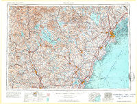
~ Portland ME topo map, 1:250000 scale, 1 X 2 Degree, Historical, 1963, updated 1963
Portland, Maine, USGS topographic map dated 1963.
Includes geographic coordinates (latitude and longitude). This topographic map is suitable for hiking, camping, and exploring, or framing it as a wall map.
Printed on-demand using high resolution imagery, on heavy weight and acid free paper, or alternatively on a variety of synthetic materials.
Topos available on paper, Waterproof, Poly, or Tyvek. Usually shipping rolled, unless combined with other folded maps in one order.
- Product Number: USGS-5684959
- Free digital map download (high-resolution, GeoPDF): Portland, Maine (file size: 21 MB)
- Map Size: please refer to the dimensions of the GeoPDF map above
- Weight (paper map): ca. 55 grams
- Map Type: POD USGS Topographic Map
- Map Series: HTMC
- Map Verison: Historical
- Cell ID: 68970
- Scan ID: 460769
- Imprint Year: 1963
- Visual Version Number: 1
- Field Check Year: 1956
- Datum: Unstated
- Map Projection: Transverse Mercator
- Map published by United States Geological Survey
- Map published by United States Army Corps of Engineers
- Map published by United States Army
- Map Language: English
- Scanner Resolution: 600 dpi
- Map Cell Name: Portland
- Grid size: 1 X 2 Degree
- Date on map: 1963
- Map Scale: 1:250000
- Geographical region: Maine, United States
Neighboring Maps:
All neighboring USGS topo maps are available for sale online at a variety of scales.
Spatial coverage:
Topo map Portland, Maine, covers the geographical area associated the following places:
- Ross Corner - Ocean View Village - Meeting House Hill - Wells Beach Station - Lower Village - Bayside - Wildes Corner - Cliff Island Landing - South Bridgton - Bradford Center - Freeport - South Alexandria - Pine Point Beach - Jones Wharf - Pleasant Hill - Center Lebanon - Loudon Center - Contoocook - Melrose Corner - Goose Corner - Bustins Island - Dingit Corner - Kinney Shores - Mount Major - Four Corners - South Wolfeboro - Intervale - Woodstock - North Wilmot - Rosemont - Cushing Briggs - Falmouth Foreside - Lower Village (historical) - Cain Crest Trailer Park - Popeville - Greenland Station - East Springfield - Tilton - Gerrish - East Brownfield - Center Barnstead - Sanbornville - Rockingham - East Candia - Miller Corner - East Andover - Airport Village - West Lebanon - Wawbeek - South Sanford - Lake Shore Park - Puddle Dock (historical) - Western Landing - Two Trails - Deephaven - West Scarborough - East Grafton - Effingham - Brookhurst - Wilmot - Acorn Acres - Moody - Grape Corner - Seavey Island - Crockett Corner - Kezer Seminary - Cleaves Landing - Riverton - Slab City - Lower Village - Eliot - Fairhill Manor - Meredith Hill - Rigby (historical) - Shingle Mill Corner - Lower Landing - Arundel - Webster Lake - Interlaken Park - Spang Mills - Gilford - Canterbury Station - Maplewood - Edes Falls - Quint - Dolley Corner - Pownal Center - Ferry Village - Cumberland Mills - Blueberry Ridge Trailer Park - Blaisdell Corners - Sunset Landing - Ligonia - South Hiram - Felch Corner - East Baldwin Mattocks Station - Delano Park - Pearls Corner - Whiteface - Elkins
- Map Area ID: AREA4443-72-70
- Northwest corner Lat/Long code: USGSNW44-72
- Northeast corner Lat/Long code: USGSNE44-70
- Southwest corner Lat/Long code: USGSSW43-72
- Southeast corner Lat/Long code: USGSSE43-70
- Northern map edge Latitude: 44
- Southern map edge Latitude: 43
- Western map edge Longitude: -72
- Eastern map edge Longitude: -70


