
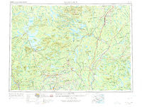
~ Millinocket ME topo map, 1:250000 scale, 1 X 2 Degree, Historical, 1954, updated 1975
Millinocket, Maine, USGS topographic map dated 1954.
Includes geographic coordinates (latitude and longitude). This topographic map is suitable for hiking, camping, and exploring, or framing it as a wall map.
Printed on-demand using high resolution imagery, on heavy weight and acid free paper, or alternatively on a variety of synthetic materials.
Topos available on paper, Waterproof, Poly, or Tyvek. Usually shipping rolled, unless combined with other folded maps in one order.
- Product Number: USGS-5684645
- Free digital map download (high-resolution, GeoPDF): Millinocket, Maine (file size: 17 MB)
- Map Size: please refer to the dimensions of the GeoPDF map above
- Weight (paper map): ca. 55 grams
- Map Type: POD USGS Topographic Map
- Map Series: HTMC
- Map Verison: Historical
- Cell ID: 75021
- Scan ID: 460610
- Imprint Year: 1975
- Woodland Tint: Yes
- Visual Version Number: 1
- Edit Year: 1967
- Field Check Year: 1954
- Datum: Unstated
- Map Projection: Transverse Mercator
- Map published by United States Geological Survey
- Map published by United States Army Corps of Engineers
- Map published by United States Army
- Map Language: English
- Scanner Resolution: 600 dpi
- Map Cell Name: Millinocket
- Grid size: 1 X 2 Degree
- Date on map: 1954
- Map Scale: 1:250000
- Geographical region: Maine, United States
Neighboring Maps:
All neighboring USGS topo maps are available for sale online at a variety of scales.
Spatial coverage:
Topo map Millinocket, Maine, covers the geographical area associated the following places:
- Seboomook - Medford Center - Rollins Mill - Parkers - Lower Shirley Corner - Brighton - Stephensons Landing - Pleasant Pond - Oak Park Manor - The Highlands - Edes Corner - Berrys Corner - Mayfield Corner - Deadwater - Gordon (historical) - Morgan Beach - Crockertown - Howland - Seboeis - Greenbush - Dolby - Knight Corner - Meadowville - Morkill - Benedicta - Garland - East Millinocket - Brownville Junction - Webb Hill - Perkins - Gilman Corner - Willimantic - Bowden (historical) - Gilford - Atkinson Mills - Sangerville - Gantners Landing - Huff Corner - City Camp Landing - Schoodic - Oliver Hill Corner - Earnest Corner - Stacyville - Burlington - Packards - Greenville - Glenwood - Steadman Landing - High Landing - Olamon - Johnson Corner - Upper Shirley Corner - East Lowell - South Sebec - Upper Abbot - Jordan Mills - Prairie - Moscow - Silverwood Court - Dover South Mills - Preble Corner - Gordon Corner - Medford - West Seboeis - Chester - Back Settlement - Patten - Monson Junction - Bodfish - Dover-Foxcroft - Packard Landing - Hay Brook - Little Italy - Moody Corner - Milo - Saponac - Starbirds - Caratunk - Brassua - Sebec Lake - Ogontz - Abbot Village - Sherman - Goodell Corner - Moosehead - Derby - Earley Landing - Lincoln Center - Springfield - Argyle - West Dover - Woodard (historical) - Burdin Corner - West Charleston - Wellington - Jackman Corner - Hicks Corner - Kingman - South Dover - Huntington Mill
- Map Area ID: AREA4645-70-68
- Northwest corner Lat/Long code: USGSNW46-70
- Northeast corner Lat/Long code: USGSNE46-68
- Southwest corner Lat/Long code: USGSSW45-70
- Southeast corner Lat/Long code: USGSSE45-68
- Northern map edge Latitude: 46
- Southern map edge Latitude: 45
- Western map edge Longitude: -70
- Eastern map edge Longitude: -68


