
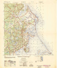
~ Duxbury MA topo map, 1:25000 scale, 7.5 X 7.5 Minute, Historical, 1953, updated 1954
Duxbury, Massachusetts, USGS topographic map dated 1953.
Includes geographic coordinates (latitude and longitude). This topographic map is suitable for hiking, camping, and exploring, or framing it as a wall map.
Printed on-demand using high resolution imagery, on heavy weight and acid free paper, or alternatively on a variety of synthetic materials.
Topos available on paper, Waterproof, Poly, or Tyvek. Usually shipping rolled, unless combined with other folded maps in one order.
- Product Number: USGS-5683527
- Free digital map download (high-resolution, GeoPDF): Duxbury, Massachusetts (file size: 18 MB)
- Map Size: please refer to the dimensions of the GeoPDF map above
- Weight (paper map): ca. 55 grams
- Map Type: POD USGS Topographic Map
- Map Series: HTMC
- Map Verison: Historical
- Cell ID: 13190
- Scan ID: 350917
- Imprint Year: 1954
- Woodland Tint: Yes
- Edit Year: 1947
- Datum: NAD27
- Map Projection: Transverse Mercator
- Map published by United States Geological Survey
- Map published by United States Army Corps of Engineers
- Map published by United States Army
- Keywords: Overedge with No Adjacent Map
- Map Language: English
- Scanner Resolution: 600 dpi
- Map Cell Name: Duxbury
- Grid size: 7.5 X 7.5 Minute
- Date on map: 1953
- Map Scale: 1:25000
- Geographical region: Massachusetts, United States
Neighboring Maps:
All neighboring USGS topo maps are available for sale online at a variety of scales.
Spatial coverage:
Topo map Duxbury, Massachusetts, covers the geographical area associated the following places:
- Marshfield Center - Tarkiln - Brant Rock - Duxbury - South Duxbury - Baileys Corner - Island Creek - Cox Corner - Tree of Knowledge Corner - Ocean Bluff - Millbrook - North Duxbury - Green Harbor - Kent Park - Camp Chappa Challa - Miramar - Fieldston - Miles Standish Park - Rexhame - Tinkertown - Northwest Duxbury - Marshfield - Cedar Crest
- Map Area ID: AREA42.12542-70.75-70.625
- Northwest corner Lat/Long code: USGSNW42.125-70.75
- Northeast corner Lat/Long code: USGSNE42.125-70.625
- Southwest corner Lat/Long code: USGSSW42-70.75
- Southeast corner Lat/Long code: USGSSE42-70.625
- Northern map edge Latitude: 42.125
- Southern map edge Latitude: 42
- Western map edge Longitude: -70.75
- Eastern map edge Longitude: -70.625


