
~ Ukiah CA topo map, 1:250000 scale, 1 X 2 Degree, Historical, 1957, updated 1974
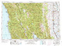
Ukiah, California, USGS topographic map dated 1957.
Includes geographic coordinates (latitude and longitude). This topographic map is suitable for hiking, camping, and exploring, or framing it as a wall map.
Printed on-demand using high resolution imagery, on heavy weight and acid free paper, or alternatively on a variety of synthetic materials.
Topos available on paper, Waterproof, Poly, or Tyvek. Usually shipping rolled, unless combined with other folded maps in one order.
- Product Number: USGS-5683235
- Free digital map download (high-resolution, GeoPDF): Ukiah, California (file size: 25 MB)
- Map Size: please refer to the dimensions of the GeoPDF map above
- Weight (paper map): ca. 55 grams
- Map Type: POD USGS Topographic Map
- Map Series: HTMC
- Map Verison: Historical
- Cell ID: 69070
- Scan ID: 302180
- Imprint Year: 1974
- Woodland Tint: Yes
- Aerial Photo Year: 1968
- Edit Year: 1971
- Field Check Year: 1957
- Datum: Unstated
- Map Projection: Transverse Mercator
- Map published by: Military, Other
- Keywords: Overedge with No Adjacent Map
- Map Language: English
- Scanner Resolution: 600 dpi
- Map Cell Name: Ukiah
- Grid size: 1 X 2 Degree
- Date on map: 1957
- Map Scale: 1:250000
- Geographical region: California, United States
Neighboring Maps:
All neighboring USGS topo maps are available for sale online at a variety of scales.
Spatial coverage:
Topo map Ukiah, California, covers the geographical area associated the following places:
- Steuben Place - Mina - Kirkwood - Navarro - Twin Rocks - Rice Fork Summer Homes - Four Pines - Pomo - Lone Star - Reynolds Place (historical) - Stegeman - Bonnie View - Three Crossing - Griffin Place - Henleyville - Lucerne - Brooktrails - Devils Elbow - Rowes (historical) - Largo - Cory - Wheeler - Reeves Place - Albion - Pine Grove - Enterprise - Alder Springs - Ramsey - Riverdale - Ridge - Grove - Upp - Melbourne - Eastlake (historical) - Vann - Kibesillah - Genevra - Marks Place - Woodman - Comptche - Hearst - Delphos - Fort Bragg - Reynolds (historical) - Saratoga Springs - Calpella - Lane Redwood Flat (historical) - Reyes Place - Wilson Place - Bollinger Place - Little River - Bayliss - Leesville - Kurand (historical) - Wyo - Bredehoft Place - Soda Springs - Sunnyside - Upper Lake - Peterson Place - Willows - Redwood Lodge - Cummings - Rockport - Ridgewood Park - Leggett - Copeland - Kenny - Alpine - Cubbler Place - Dunlap Place - Presswood - Clearlake Oaks - DeHaven - River Garden (historical) - Flournoy - Merrills Landing - Philo - Old Bailey Place - Cooper - Fruto - Caravan Mobile Home Park - Noyo - Burbeck - Montgomery - Bluegum - Wilder Place - Delevan - Valley Oaks Mobile Home Park - Marble Place - Hough Springs - Parramore Springs - Meadowood Estates - Hardy - Newman Springs - Underwood Park - Artois - South Fork - Soda Bay - Union Landing
- Map Area ID: AREA4039-124-122
- Northwest corner Lat/Long code: USGSNW40-124
- Northeast corner Lat/Long code: USGSNE40-122
- Southwest corner Lat/Long code: USGSSW39-124
- Southeast corner Lat/Long code: USGSSE39-122
- Northern map edge Latitude: 40
- Southern map edge Latitude: 39
- Western map edge Longitude: -124
- Eastern map edge Longitude: -122


