
~ Ukiah CA topo map, 1:250000 scale, 1 X 2 Degree, Historical, 1957, updated 1966
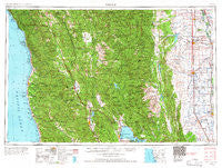
Ukiah, California, USGS topographic map dated 1957.
Includes geographic coordinates (latitude and longitude). This topographic map is suitable for hiking, camping, and exploring, or framing it as a wall map.
Printed on-demand using high resolution imagery, on heavy weight and acid free paper, or alternatively on a variety of synthetic materials.
Topos available on paper, Waterproof, Poly, or Tyvek. Usually shipping rolled, unless combined with other folded maps in one order.
- Product Number: USGS-5683233
- Free digital map download (high-resolution, GeoPDF): Ukiah, California (file size: 23 MB)
- Map Size: please refer to the dimensions of the GeoPDF map above
- Weight (paper map): ca. 55 grams
- Map Type: POD USGS Topographic Map
- Map Series: HTMC
- Map Verison: Historical
- Cell ID: 69070
- Scan ID: 302179
- Imprint Year: 1966
- Woodland Tint: Yes
- Edit Year: 1965
- Field Check Year: 1957
- Datum: Unstated
- Map Projection: Transverse Mercator
- Map published by United States Army Corps of Engineers
- Map published by United States Army
- Keywords: Overedge with No Adjacent Map
- Map Language: English
- Scanner Resolution: 600 dpi
- Map Cell Name: Ukiah
- Grid size: 1 X 2 Degree
- Date on map: 1957
- Map Scale: 1:250000
- Geographical region: California, United States
Neighboring Maps:
All neighboring USGS topo maps are available for sale online at a variety of scales.
Spatial coverage:
Topo map Ukiah, California, covers the geographical area associated the following places:
- Noyo - Barkerville (historical) - Kenny - Bollinger Place - Arbuckle - Caspar - Elk - Whitlock Place - Elk Creek - Ralph Leggett Place - Lakeport - Andersonia - College City - Soda Springs - Pepperwood Grove - Tan Oak Park - Meyers Place - Lurline (historical) - Leggett - Flournoy - Kirkwood - Hamilton City - Covelo - Glenn - Cameron - Soda Springs - Ukiah Rancheria - Corning - Farley - Redwood Lodge - Cooper - Copper City - Branscomb - Vina - Henleyville - Muir - Fouts Springs - DeHaven - Whiskey Springs - Capay - Reilly Heights - Bayliss - Clare Mill - Tatu - Genevra - Leesville - Orrs Springs - Jacinto - Westport - Delphos - Regina Heights - Bowman Place - Maxwell - Willow Glenn Mobile Home Park - Mills Orchards - Dogtown - Wyo - Shake City - Wilson Place - Wheeler - Richfield - Reyes Place - Norman - Indian Springs - Reeves Place - Ridgewood Park - Fort Bragg - Presswood - Willows - Lane Redwood Flat (historical) - Northspur - Meadowood Estates - Jim Leggett Place - Prize (historical) - Heath Place - Saratoga Springs - Mendocino - Fair Oaks - Riverdale - Kurand (historical) - Wagon Wheel Mobile Home Park - Stonyford - Soda Bay - Burbeck - DeCamp - Bonnie View - River Garden (historical) - Cortena - Logandale - Wanhala - Hough Springs - Hardy - El Roble - Melbourne - Steuben Place - Copeland - Sherburns (historical) - Woodman - Dawson Place - South Fork
- Map Area ID: AREA4039-124-122
- Northwest corner Lat/Long code: USGSNW40-124
- Northeast corner Lat/Long code: USGSNE40-122
- Southwest corner Lat/Long code: USGSSW39-124
- Southeast corner Lat/Long code: USGSSE39-122
- Northern map edge Latitude: 40
- Southern map edge Latitude: 39
- Western map edge Longitude: -124
- Eastern map edge Longitude: -122


