
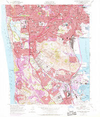
~ San Francisco South CA topo map, 1:24000 scale, 7.5 X 7.5 Minute, Historical, 1956, updated 1969
San Francisco South, California, USGS topographic map dated 1956.
Includes geographic coordinates (latitude and longitude). This topographic map is suitable for hiking, camping, and exploring, or framing it as a wall map.
Printed on-demand using high resolution imagery, on heavy weight and acid free paper, or alternatively on a variety of synthetic materials.
Topos available on paper, Waterproof, Poly, or Tyvek. Usually shipping rolled, unless combined with other folded maps in one order.
- Product Number: USGS-5683099
- Free digital map download (high-resolution, GeoPDF): San Francisco South, California (file size: 19 MB)
- Map Size: please refer to the dimensions of the GeoPDF map above
- Weight (paper map): ca. 55 grams
- Map Type: POD USGS Topographic Map
- Map Series: HTMC
- Map Verison: Historical
- Cell ID: 71507
- Scan ID: 300070
- Imprint Year: 1969
- Woodland Tint: Yes
- Photo Revision Year: 1968
- Aerial Photo Year: 1968
- Field Check Year: 1956
- Datum: NAD27
- Map Projection: Polyconic
- Map published by United States Geological Survey
- Keywords: Overedge with No Adjacent Map
- Map Language: English
- Scanner Resolution: 600 dpi
- Map Cell Name: San Francisco South
- Grid size: 7.5 X 7.5 Minute
- Date on map: 1956
- Map Scale: 1:24000
- Geographical region: California, United States
Neighboring Maps:
All neighboring USGS topo maps are available for sale online at a variety of scales.
Spatial coverage:
Topo map San Francisco South, California, covers the geographical area associated the following places:
- West Portal - Bayview District - Ingleside Heights - Park Merced - Sherwood Forest - Gold Mine Hill - Eldton - Meadowbrook Mobile Home Park - Westborough - Saint Francis Wood - Treasure Island Mobile Home Park - Ingleside - South San Francisco - Merced Manor - Daly City - Pacific Manor - Brisbane - Broadmoor - Westlake - Tanforan - Red Arrow Mobile Home Park - Pacific Skies Mobile Home Park - Silver Terrace - Diamond Heights Village - Broadmoor Village - San Bruno - Oceanview - Bayshore - Edgemar - Baden - Forest Hill - Village Square - Colma - Vista Del Monte - Andry Mobile Home Park - Ingleside Terrace - Glenridge - Stonestown - Merced Heights - Franciscan Mobile Home Park - Sholun - Sharp Park
- Map Area ID: AREA37.7537.625-122.5-122.375
- Northwest corner Lat/Long code: USGSNW37.75-122.5
- Northeast corner Lat/Long code: USGSNE37.75-122.375
- Southwest corner Lat/Long code: USGSSW37.625-122.5
- Southeast corner Lat/Long code: USGSSE37.625-122.375
- Northern map edge Latitude: 37.75
- Southern map edge Latitude: 37.625
- Western map edge Longitude: -122.5
- Eastern map edge Longitude: -122.375


