
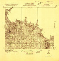
~ Little Table Mountain CA topo map, 1:31680 scale, 7.5 X 7.5 Minute, Historical, 1916
Little Table Mountain, California, USGS topographic map dated 1916.
Includes geographic coordinates (latitude and longitude). This topographic map is suitable for hiking, camping, and exploring, or framing it as a wall map.
Printed on-demand using high resolution imagery, on heavy weight and acid free paper, or alternatively on a variety of synthetic materials.
Topos available on paper, Waterproof, Poly, or Tyvek. Usually shipping rolled, unless combined with other folded maps in one order.
- Product Number: USGS-5682887
- Free digital map download (high-resolution, GeoPDF): Little Table Mountain, California (file size: 7 MB)
- Map Size: please refer to the dimensions of the GeoPDF map above
- Weight (paper map): ca. 55 grams
- Map Type: POD USGS Topographic Map
- Map Series: HTMC
- Map Verison: Historical
- Cell ID: 26059
- Scan ID: 296258
- Survey Year: 1916
- Datum: Unstated
- Map Projection: Unstated
- Advance: Yes
- Map published by United States Geological Survey
- Keywords: Overedge; Nonstandard Press Run
- Map Language: English
- Scanner Resolution: 600 dpi
- Map Cell Name: Little Table Mountain
- Grid size: 7.5 X 7.5 Minute
- Date on map: 1916
- Map Scale: 1:31680
- Geographical region: California, United States
Neighboring Maps:
All neighboring USGS topo maps are available for sale online at a variety of scales.
Spatial coverage:
Topo map Little Table Mountain, California, covers the geographical area associated the following places:
- Marysdale School (historical) - Bates Station - Shaubach Ranch - Davis Ranch - Lake Jane 686 Dam - Urrutia Ranch - Four Corners - Adobe Hill - Morris Ranch (historical) - Zebra Station - Shannon Ranch - Urrutia Feedlot - Wide Awake Ranch - Little Table Mountain - Twentytwo Mile House
- Map Area ID: AREA37.12537-119.875-119.75
- Northwest corner Lat/Long code: USGSNW37.125-119.875
- Northeast corner Lat/Long code: USGSNE37.125-119.75
- Southwest corner Lat/Long code: USGSSW37-119.875
- Southeast corner Lat/Long code: USGSSE37-119.75
- Northern map edge Latitude: 37.125
- Southern map edge Latitude: 37
- Western map edge Longitude: -119.875
- Eastern map edge Longitude: -119.75


