
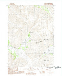
~ Seward D 5 SW AK topo map, 1:25000 scale, 7.5 X 7.5 Minute, Historical, 1984, updated 1984
Seward D 5 SW, Alaska, USGS topographic map dated 1984.
Includes geographic coordinates (latitude and longitude). This topographic map is suitable for hiking, camping, and exploring, or framing it as a wall map.
Printed on-demand using high resolution imagery, on heavy weight and acid free paper, or alternatively on a variety of synthetic materials.
Topos available on paper, Waterproof, Poly, or Tyvek. Usually shipping rolled, unless combined with other folded maps in one order.
- Product Number: USGS-5682411
- Free digital map download (high-resolution, GeoPDF): Seward D 5 SW, Alaska (file size: 19 MB)
- Map Size: please refer to the dimensions of the GeoPDF map above
- Weight (paper map): ca. 55 grams
- Map Type: POD USGS Topographic Map
- Map Series: HTMC
- Map Verison: Historical
- Cell ID: 40685
- Scan ID: 353801
- Imprint Year: 1984
- Woodland Tint: Yes
- Aerial Photo Year: 1976
- Edit Year: 1984
- Field Check Year: 1979
- Datum: NAD27
- Map Projection: Universal Transverse Mercator
- Provisional map: Yes
- Map published by United States Geological Survey
- Map Language: English
- Scanner Resolution: 600 dpi
- Map Cell Name: Seward D-5 SW
- Grid size: 7.5 X 7.5 Minute
- Date on map: 1984
- Map Scale: 1:25000
- Geographical region: Alaska, United States
Neighboring Maps:
All neighboring USGS topo maps are available for sale online at a variety of scales.
Spatial coverage:
Topo map Seward D 5 SW, Alaska, covers the geographical area associated the following places:
- Anton Anderson Tunnel - Whittier Airport - Shakespeare Shoulder - Bear Valley - Shakespeare Glacier - Lowell Glacier - Placer Creek - Begich Boggs Visitor Center - Moraine - Portage Lake - Boggs Peak - Portage Pass - Divide Lake - Begich Peak - Anton Anderson Memorial Tunnel Fire Brigade - Learnard Glacier - Whittier Creek - Maynard Mountain
- Map Area ID: AREA60.87560.75-148.875-148.6875
- Northwest corner Lat/Long code: USGSNW60.875-148.875
- Northeast corner Lat/Long code: USGSNE60.875-148.6875
- Southwest corner Lat/Long code: USGSSW60.75-148.875
- Southeast corner Lat/Long code: USGSSE60.75-148.6875
- Northern map edge Latitude: 60.875
- Southern map edge Latitude: 60.75
- Western map edge Longitude: -148.875
- Eastern map edge Longitude: -148.6875


