
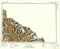
~ Bradfield Canal AK topo map, 1:250000 scale, 1 X 2 Degree, Historical, 1951, updated 1953
Bradfield Canal, Alaska, USGS topographic map dated 1951.
Includes geographic coordinates (latitude and longitude). This topographic map is suitable for hiking, camping, and exploring, or framing it as a wall map.
Printed on-demand using high resolution imagery, on heavy weight and acid free paper, or alternatively on a variety of synthetic materials.
Topos available on paper, Waterproof, Poly, or Tyvek. Usually shipping rolled, unless combined with other folded maps in one order.
- Product Number: USGS-5682023
- Free digital map download (high-resolution, GeoPDF): Bradfield Canal, Alaska (file size: 20 MB)
- Map Size: please refer to the dimensions of the GeoPDF map above
- Weight (paper map): ca. 55 grams
- Map Type: POD USGS Topographic Map
- Map Series: HTMC
- Map Verison: Historical
- Cell ID: 68686
- Scan ID: 360700
- Imprint Year: 1953
- Visual Version Number: 1
- Survey Year: 1947
- Datum: NAD27
- Map Projection: Universal Transverse Mercator
- Shaded Relief map: Yes
- Map published by United States Geological Survey
- Map published by United States Forest Service
- Map Language: English
- Scanner Resolution: 600 dpi
- Map Cell Name: Bradfield Canal
- Grid size: 1 X 2 Degree
- Date on map: 1951
- Map Scale: 1:250000
- Geographical region: Alaska, United States
Neighboring Maps:
All neighboring USGS topo maps are available for sale online at a variety of scales.
Spatial coverage:
Topo map Bradfield Canal, Alaska, covers the geographical area associated the following places:
- Sawmill Slough - West Fork Texas Creek - Smith Lake - Clara Smith Glacier - Harding River - Anan Lagoon - Hoya Creek - Standing Rock Lake - Blue Lake - Matney Ranch - Riverside Mine - Texas Glacier - Seward Passage - Halfmoon Lake - Lake Rowena - First Canyon - Klahini River - Frosty Bay - Campbell Lake - Unuk River - Ninemile Mountain - Guerin Slough - Mount Wilson - Mosheim Dome - Goat Creek - Mount Lewis Cass - Mineral Hill - Eulachon River - Willow Islands - Texas Creek - KTKN-AM (Ketchikan) - Government Cabin - Ketili River - Duck Point - Chickamin Glacier - Marten Lake - Red Slough - Boundary Glacier - Mount Tyee - Fall Lake - Banded Mountain - Eagle Bay - Elbow Mountain - Kikahe River - Mount Talbot - Boundary Peak 18 - Mount Stoeckl - Clay Lake - Gracey Creek - Mount Welker - Kapho Mountains - Berg Mountain - Mount John Jay - Anan Bay - Gray Glacier - West Fork Katete River - Short Creek - Gracey Creek Glacier - Aaron Creek - Hidden Creek - Frosty Creek - Clay Lake - Mount Gallatin - Point Warde - Dickins Peak - East Fork Anan Creek - Upper Marten Lake - Barnes Lake - Lava Fork - Ibex Creek - Cabin Creek - Daly Creek - Marten Creek - Ferguson Glacier - East Fork Bradfield River - Bishop Ranch - Spur Mountain - Tasakili River - Eagle River - Lake Nellie - Mount Fawcett - Mount Flemer - Mount Middleton - Anan Lake - Hidden Glacier - Blake Channel - West Fork Blue River - Bradfield River - Ketili Creek - White River - South Fork Craig River - Mount Upshur - Grant Creek - Casey Glacier - Albert Ridge - Lake Creek - Reflection Lake - Mount Cloud - Mount Whipple - Katete River
- Map Area ID: AREA5756-132-130
- Northwest corner Lat/Long code: USGSNW57-132
- Northeast corner Lat/Long code: USGSNE57-130
- Southwest corner Lat/Long code: USGSSW56-132
- Southeast corner Lat/Long code: USGSSE56-130
- Northern map edge Latitude: 57
- Southern map edge Latitude: 56
- Western map edge Longitude: -132
- Eastern map edge Longitude: -130


