
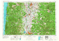
~ Salem OR topo map, 1:250000 scale, 1 X 2 Degree, Historical, 1963, updated 1963
Salem, Oregon, USGS topographic map dated 1963.
Includes geographic coordinates (latitude and longitude). This topographic map is suitable for hiking, camping, and exploring, or framing it as a wall map.
Printed on-demand using high resolution imagery, on heavy weight and acid free paper, or alternatively on a variety of synthetic materials.
Topos available on paper, Waterproof, Poly, or Tyvek. Usually shipping rolled, unless combined with other folded maps in one order.
- Product Number: USGS-5680653
- Free digital map download (high-resolution, GeoPDF): Salem, Oregon (file size: 27 MB)
- Map Size: please refer to the dimensions of the GeoPDF map above
- Weight (paper map): ca. 55 grams
- Map Type: POD USGS Topographic Map
- Map Series: HTMC
- Map Verison: Historical
- Cell ID: 75020
- Scan ID: 283353
- Imprint Year: 1963
- Woodland Tint: Yes
- Field Check Year: 1960
- Datum: Unstated
- Map Projection: Transverse Mercator
- Map published by United States Geological Survey
- Map published by United States Army Corps of Engineers
- Map published by United States Army
- Map Language: English
- Scanner Resolution: 600 dpi
- Map Cell Name: Salem
- Grid size: 1 X 2 Degree
- Date on map: 1963
- Map Scale: 1:250000
- Geographical region: Oregon, United States
Neighboring Maps:
All neighboring USGS topo maps are available for sale online at a variety of scales.
Spatial coverage:
Topo map Salem, Oregon, covers the geographical area associated the following places:
- Albany - Rainbow - Blodgett - Foley Springs - Triangle Lake - Bayview - Brickerville - Minerva - Noon - Millersburg - Turner - Irving - Mercer (historical) - Calloway (historical) - Oceanlake - Wendling - Tidewater - Rainrock - Yachats - Fir Villa - Chapman Corner - Ale (historical) - Fox Valley - South Lebanon - Corvallis - Linslaw - Leaburg - Nashville - College Hill - Ocean Park - Burlington (historical) - Berlin - Keas Corner - Thurston - Pratum - Bellfountain - Talbot - Oak Park - Walton - Putnam (historical) - Bayshore - West Stayton - Santiam Terrace - Middle Grove - Holley - Ferns (historical) - Liberty - Clymer (historical) - Toledo - Elk City - Airlie - Suver - Flynn - Goldson - Liberty - Searose Beach - Elkhorn - Wren - Deerhorn - Morrison (historical) - Siletz - Santiam City (historical) - Bowersville (historical) - Stayton - Little Albany - Mill City - Heceta Beach - Eddyville - Sublimity - Sunnyside - Buena Vista - Macleay - Fern Ridge Shores - Lebanon - Cutler City - Four Cabin Corner - Philomath - Lincoln Beach - Monroe - Belknap Springs - Glen (historical) - Hoskins - Fruitvale - Idanha - Delake - Salem - Tiernan - Indiola - McKenzie Bridge - Low Pass - Aumsville - River Road - Coronado Shores - Westwood Village - Estrup (historical) - Glenbrook - Tillicum Beach - Grabenhorst Corner - Riverside - Agate Beach
- Map Area ID: AREA4544-124.1833333-122
- Northwest corner Lat/Long code: USGSNW45-124.1833333
- Northeast corner Lat/Long code: USGSNE45-122
- Southwest corner Lat/Long code: USGSSW44-124.1833333
- Southeast corner Lat/Long code: USGSSE44-122
- Northern map edge Latitude: 45
- Southern map edge Latitude: 44
- Western map edge Longitude: -124.1833333
- Eastern map edge Longitude: -122


