
~ Long Beach CA topo map, 1:250000 scale, 1 X 2 Degree, Historical, 1949, updated 1949
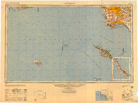
Long Beach, California, USGS topographic map dated 1949.
Includes geographic coordinates (latitude and longitude). This topographic map is suitable for hiking, camping, and exploring, or framing it as a wall map.
Printed on-demand using high resolution imagery, on heavy weight and acid free paper, or alternatively on a variety of synthetic materials.
Topos available on paper, Waterproof, Poly, or Tyvek. Usually shipping rolled, unless combined with other folded maps in one order.
- Product Number: USGS-5680585
- Free digital map download (high-resolution, GeoPDF): Long Beach, California (file size: 19 MB)
- Map Size: please refer to the dimensions of the GeoPDF map above
- Weight (paper map): ca. 55 grams
- Map Type: POD USGS Topographic Map
- Map Series: HTMC
- Map Verison: Historical
- Cell ID: 68880
- Scan ID: 707450
- Imprint Year: 1949
- Woodland Tint: Yes
- Aerial Photo Year: 1945
- Datum: NAD27
- Map Projection: Transverse Mercator
- Shaded Relief map: Yes
- Map published by United States Army Corps of Engineers
- Map published by United States Army
- Keywords: Inset
- Map Language: English
- Scanner Resolution: 508 dpi
- Map Cell Name: Long Beach
- Grid size: 1 X 2 Degree
- Date on map: 1949
- Map Scale: 1:250000
- Geographical region: California, United States
Neighboring Maps:
All neighboring USGS topo maps are available for sale online at a variety of scales.
Spatial coverage:
Topo map Long Beach, California, covers the geographical area associated the following places:
- Florence - Wingfoot - Walnut Park - Willowbrook - Los Alamitos - North Long Beach - Bingham - Cerritos - Roosevelt - Hansen - Del Ray - Jordan Downs - Surfside - Downey - Cypress - Westmont - Colima - View Park - Alondra Park - Avalon Village - Lincoln Village - Signal Hill - East Whittier - Hawaiian Gardens - Seal Beach - California Heights - Bluff Park - Gaspur (historical) - Rio Hondo - West Athens - Dominguez Junction - Watson Junction - Dudmore - San Pedro - Skandia Mobile Country Park - South Los Angeles - Morton - Rolling Hills Estates - El Segundo - Valla - La Mirada - Artesia - Westchester - Hermosillo - Cypave - Dolanco Junction - Compton - Del Aire - Imperial Courts - Huntington Harbor Mobile Home Park - Rancho Palos Verdes - South Gate - Vinvale - Norwalk - Machado (historical) - Clearwater - Ocean View Estates - Portuguese Bend - Naples - Laguna - Halcon - Del Amo - Paramount - Bixby Knolls - Avalon Gardens - Inglewood - Palos Verdes Peninsula - Ironsides - Los Nietos Junction - Holton (historical) - Harbor City - Bandini - West Carson - Moody - Sea Aria West Mobile Home Estates - Nickerson Gardens - Westminster - Royal Oak Mobile Home Park - Hacienda Village - Dominguez - Walteria - Marina del Rey - Manhattan Beach - Perry - Dolley - Workman - Gardena - Hawthorne - Bell - Simons - Hyde Park - West Rancho Dominguez - Walker - Dana Strand Village - Cota - Fulton Wells - Hyperion (historical) - Elftman - Nadeau - South Whittier
- Map Area ID: AREA3433-120-118
- Northwest corner Lat/Long code: USGSNW34-120
- Northeast corner Lat/Long code: USGSNE34-118
- Southwest corner Lat/Long code: USGSSW33-120
- Southeast corner Lat/Long code: USGSSE33-118
- Northern map edge Latitude: 34
- Southern map edge Latitude: 33
- Western map edge Longitude: -120
- Eastern map edge Longitude: -118


