
~ Long Beach CA topo map, 1:250000 scale, 1 X 2 Degree, Historical, 1957, updated 1964
Long Beach, California, USGS topographic map dated 1957.
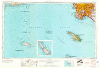
Includes geographic coordinates (latitude and longitude). This topographic map is suitable for hiking, camping, and exploring, or framing it as a wall map.
Printed on-demand using high resolution imagery, on heavy weight and acid free paper, or alternatively on a variety of synthetic materials.
Topos available on paper, Waterproof, Poly, or Tyvek. Usually shipping rolled, unless combined with other folded maps in one order.
- Product Number: USGS-5680581
- Free digital map download (high-resolution, GeoPDF): Long Beach, California (file size: 10 MB)
- Map Size: please refer to the dimensions of the GeoPDF map above
- Weight (paper map): ca. 55 grams
- Map Type: POD USGS Topographic Map
- Map Series: HTMC
- Map Verison: Historical
- Cell ID: 68880
- Scan ID: 299811
- Imprint Year: 1964
- Woodland Tint: Yes
- Edit Year: 1963
- Field Check Year: 1957
- Datum: Unstated
- Map Projection: Transverse Mercator
- Map published by United States Army Corps of Engineers
- Map published by United States Army
- Keywords: Inset
- Map Language: English
- Scanner Resolution: 600 dpi
- Map Cell Name: Long Beach
- Grid size: 1 X 2 Degree
- Date on map: 1957
- Map Scale: 1:250000
- Geographical region: California, United States
Neighboring Maps:
All neighboring USGS topo maps are available for sale online at a variety of scales.
Spatial coverage:
Topo map Long Beach, California, covers the geographical area associated the following places:
- South Gate - Belmont Heights - Lincoln Center Mobile Home Park - Paramount - Los Alamitos - Imperial Courts - Van Ness - Dudmore - Avalon Gardens - Rendalia - West Carson - Lairport - Inglewood - Del Amo - Rio Hondo - Del Ray - Seal Beach - Norwalk - Valla - Walker - Studebaker - Beachview Mobile Home Park - Dana Strand Village - Holton (historical) - Hermosillo - Two Harbors - Compton - Pueblo Del Rio Public Housing - Los Robles Mobile Home Park - Sea Breeze Trailer Park - Rossmoor - Huntington Harbor Mobile Home Park - Avalon Village - Downey - Elftman - Gardena - Pico Rivera - Sea Aria West Mobile Home Estates - Seal Beach Trailer Park - Hawaiian Gardens - San Pedro - Los Alisos Mobile Home Estates - Bell Gardens - Huntington Harbour - Machado (historical) - Willowbrook - Cypress - Cypress Grove - Nickerson Gardens - Douglas Junction - Bangle - Los Altos - Perry - Rolling Hills - Los Nietos Junction - East Whittier - Clearwater - Torrance - Hansen - Del Aire - Harbor Hills - Royal Oak Mobile Home Park - Wildasin - Bingham - Belmont Shore - McCampbell - Palos Verdes Peninsula - Barber City - Bridgedale - Cudahy - California Heights - Watts - Simons - Alondra Park - North Long Beach - Westminster - East Rancho Dominguez - Cypave - Lincoln Village - Rancho Palos Verdes - Delta - West Whittier - Los Nietos - Westmont - Rose Park - Jordan Downs - Watson Junction - Gaspur (historical) - South Los Angeles - Strawberry Park - Hollywood Riviera - Wilmington - Hawthorne - Morningside Park - Windsor Hills - Monaco - Moody - Bellflower - Dominguez - El Segundo
- Map Area ID: AREA3433-120-118
- Northwest corner Lat/Long code: USGSNW34-120
- Northeast corner Lat/Long code: USGSNE34-118
- Southwest corner Lat/Long code: USGSSW33-120
- Southeast corner Lat/Long code: USGSSE33-118
- Northern map edge Latitude: 34
- Southern map edge Latitude: 33
- Western map edge Longitude: -120
- Eastern map edge Longitude: -118


