
~ Long Beach CA topo map, 1:250000 scale, 1 X 2 Degree, Historical, 1960, updated 1960
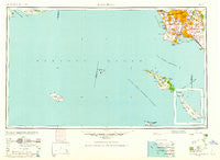
Long Beach, California, USGS topographic map dated 1960.
Includes geographic coordinates (latitude and longitude). This topographic map is suitable for hiking, camping, and exploring, or framing it as a wall map.
Printed on-demand using high resolution imagery, on heavy weight and acid free paper, or alternatively on a variety of synthetic materials.
Topos available on paper, Waterproof, Poly, or Tyvek. Usually shipping rolled, unless combined with other folded maps in one order.
- Product Number: USGS-5680579
- Free digital map download (high-resolution, GeoPDF): Long Beach, California (file size: 9 MB)
- Map Size: please refer to the dimensions of the GeoPDF map above
- Weight (paper map): ca. 55 grams
- Map Type: POD USGS Topographic Map
- Map Series: HTMC
- Map Verison: Historical
- Cell ID: 68880
- Scan ID: 299810
- Imprint Year: 1960
- Woodland Tint: Yes
- Aerial Photo Year: 1945
- Datum: NAD27
- Map Projection: Transverse Mercator
- Map published by United States Army Corps of Engineers
- Map published by United States Army
- Keywords: Inset
- Map Language: English
- Scanner Resolution: 600 dpi
- Map Cell Name: Long Beach
- Grid size: 1 X 2 Degree
- Date on map: 1960
- Map Scale: 1:250000
- Geographical region: California, United States
Neighboring Maps:
All neighboring USGS topo maps are available for sale online at a variety of scales.
Spatial coverage:
Topo map Long Beach, California, covers the geographical area associated the following places:
- Dominguez - Westminster - Wrigley - Los Nietos - Moody - West Rancho Dominguez - Torrance - La Palma - Pico Rivera - Culver Garden - Avalon Village - Dana Strand Village - Fulton Wells - South Gate - Graham - Alondra Park - California Heights - Beachview Mobile Home Park - Wingfoot - Lawndale - Walteria - Belmont Shore - Bluff Heights - Willowville - Cerritos - Harbor City - Hyde Park - Strawberry Park - Vista del Mar - Hermosa Beach - Westchester - Sea Aria West Mobile Home Estates - Dolores - Friendly Hills - Los Nietos Junction - Valla - Avalon - Signal Hill - Firestone Park - Alsace - Cambodia Town - Compton - Rolling Hills - Harbor Hills - Seal Beach - Playa Vista - Artesia - East Whittier - Hollydale - Watson - Playa del Rey - Los Alamitos - Rolling Hills Estates - Los Alisos Mobile Home Estates - Keystone - Dolanco Junction - Barber City - Palisades Del Rey (historical) - Dudmore - South Los Angeles - Southwest Village - Evergreen (historical) - Florence - Rose Park - Morningside Park - McCampbell - Elftman - Venice - Miraleste - Lincoln Village - Maywood - Palos Verdes Peninsula - Athens - Carmenita - Gage - Thenard - Cota - Sea Breeze Trailer Park - Ocean View Estates - Downey - Delta - Simons - Shirley - Walnut Park - Redondo Beach - Walker - View Park - Watts - Lennox - Lynwood - Laguna - Lairport - Clifton - Sea Aria East Mobile Home Estates - Wildasin - Cudahy - Lynwood Gardens - Bandini - Avalon Gardens - Rancho Palos Verdes
- Map Area ID: AREA3433-120-118
- Northwest corner Lat/Long code: USGSNW34-120
- Northeast corner Lat/Long code: USGSNE34-118
- Southwest corner Lat/Long code: USGSSW33-120
- Southeast corner Lat/Long code: USGSSE33-118
- Northern map edge Latitude: 34
- Southern map edge Latitude: 33
- Western map edge Longitude: -120
- Eastern map edge Longitude: -118


