
~ Truckee CA topo map, 1:96000 scale, 30 X 30 Minute, Historical, 1932
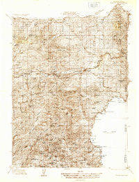
Truckee, California, USGS topographic map dated 1932.
Includes geographic coordinates (latitude and longitude). This topographic map is suitable for hiking, camping, and exploring, or framing it as a wall map.
Printed on-demand using high resolution imagery, on heavy weight and acid free paper, or alternatively on a variety of synthetic materials.
Topos available on paper, Waterproof, Poly, or Tyvek. Usually shipping rolled, unless combined with other folded maps in one order.
- Product Number: USGS-5680211
- Free digital map download (high-resolution, GeoPDF): Truckee, California (file size: 17 MB)
- Map Size: please refer to the dimensions of the GeoPDF map above
- Weight (paper map): ca. 55 grams
- Map Type: POD USGS Topographic Map
- Map Series: HTMC
- Map Verison: Historical
- Cell ID: 66813
- Scan ID: 299043
- Edit Year: 1932
- Datum: NAD27
- Map Projection: Polyconic
- Advance: Yes
- Map published by United States Geological Survey
- Keywords: Overedge; Nonstandard Press Run
- Map Language: English
- Scanner Resolution: 600 dpi
- Map Cell Name: Truckee
- Grid size: 30 X 30 Minute
- Date on map: 1932
- Map Scale: 1:96000
- Geographical region: California, United States
Neighboring Maps:
All neighboring USGS topo maps are available for sale online at a variety of scales.
Spatial coverage:
Topo map Truckee, California, covers the geographical area associated the following places:
- Tahoma Meadows - Prosser Lake Heights - Polaris - Tamarack (historical) - Spruce (historical) - Andover (historical) - Donner - Olympic Heights - Tahoma - Talmont - Gelatt - Tahoe Park - Eder - Carnelian Bay - Brockway Vista - Gilberts - Kingswood Estates - Ponderosa Palisades - Glenridge Park - Stanford (historical) - Donner Lake Village - Rubicon Properties - Union Mills - Chamberlands Estates - Calvada (historical) - Pine Land - Tahoe Pines - Armstrong - Sunnyside - Meadow Lake Park - Lake Forest - Weeks Tract - Hinton - Tahoe Estates - Troy - Norden - Floriston - Tahoe Marina Estates - Crystal Bay - Kings Beach - Ponderosa Fairway Estates - Tahoe Vista - Southside Highlands - Comstock Acres - Twin Peaks Estates - Frosts (historical) - Pomins - The Cedars - Brockway - Donner Pines Tract - Homewood - Lakeview - Hobart Mills - Carnelian Heights - Andover - Jacobsen (historical) - Meeks Bay - Prosser (historical) - Mystic - Boca - Prosser Lakeview Estates - Wood Vista - Tahoe Woods - Soda Springs - Gateway - Timberland - Alpine Meadows - Soda Springs - Hirschdale - Iceland - Chambers Lodge - Truckee - Kingvale - Ridgewood - Bronco - Donner Woods - Dollar Point - Rubicon Springs (historical) - Tahoe City - Rampart - Idlewild
- Map Area ID: AREA39.539-120.5-120
- Northwest corner Lat/Long code: USGSNW39.5-120.5
- Northeast corner Lat/Long code: USGSNE39.5-120
- Southwest corner Lat/Long code: USGSSW39-120.5
- Southeast corner Lat/Long code: USGSSE39-120
- Northern map edge Latitude: 39.5
- Southern map edge Latitude: 39
- Western map edge Longitude: -120.5
- Eastern map edge Longitude: -120


