
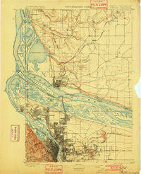
~ Portland OR topo map, 1:62500 scale, 15 X 15 Minute, Historical, 1897, updated 1901
Portland, Oregon, USGS topographic map dated 1897.
Includes geographic coordinates (latitude and longitude). This topographic map is suitable for hiking, camping, and exploring, or framing it as a wall map.
Printed on-demand using high resolution imagery, on heavy weight and acid free paper, or alternatively on a variety of synthetic materials.
Topos available on paper, Waterproof, Poly, or Tyvek. Usually shipping rolled, unless combined with other folded maps in one order.
- Product Number: USGS-5679931
- Free digital map download (high-resolution, GeoPDF): Portland, Oregon (file size: 9 MB)
- Map Size: please refer to the dimensions of the GeoPDF map above
- Weight (paper map): ca. 55 grams
- Map Type: POD USGS Topographic Map
- Map Series: HTMC
- Map Verison: Historical
- Cell ID: 61227
- Scan ID: 282793
- Imprint Year: 1901
- Survey Year: 1896
- Datum: Unstated
- Map Projection: Unstated
- Map published by United States Geological Survey
- Keywords: Overedge
- Map Language: English
- Scanner Resolution: 600 dpi
- Map Cell Name: Portland
- Grid size: 15 X 15 Minute
- Date on map: 1897
- Map Scale: 1:62500
- Geographical region: Oregon, United States
Neighboring Maps:
All neighboring USGS topo maps are available for sale online at a variety of scales.
Spatial coverage:
Topo map Portland, Oregon, covers the geographical area associated the following places:
- Albina - McLoughlin Heights - North Portland - Hidden - Image - McLoughlin - Russell Landing - Union - Lakeshore - Portland - Parkrose - Homan - Fisher - Hollywood - Officers Row - Montavilla - University Park - Walnut Grove - Brush Prairie - Felida - Sifton - Ellsworth - Salmon Creek - Laurelhurst - Vanport City (historical) - Lake Shore - Irvington - Willamette Heights - Orchards - East Portland - Five Corners - Burton - Faloma - Green Hills - Portland Heights - Piedmont - Sylvan - Evergreen - Powellhurst - Kings Heights - Mount Vista - Knapp - Vancouver - Hazel Dell - Alameda - Saint John - Rye - Kenton - Barberton - Maywood Park - Minnehaha - Vancouver Junction - Hazelwood - Burton Homes - Russellville
- Map Area ID: AREA45.7545.5-122.75-122.5
- Northwest corner Lat/Long code: USGSNW45.75-122.75
- Northeast corner Lat/Long code: USGSNE45.75-122.5
- Southwest corner Lat/Long code: USGSSW45.5-122.75
- Southeast corner Lat/Long code: USGSSE45.5-122.5
- Northern map edge Latitude: 45.75
- Southern map edge Latitude: 45.5
- Western map edge Longitude: -122.75
- Eastern map edge Longitude: -122.5


