
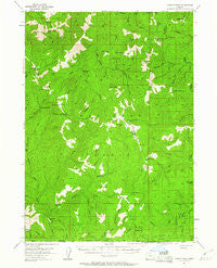
~ Chetco Peak OR topo map, 1:62500 scale, 15 X 15 Minute, Historical, 1954, updated 1961
Chetco Peak, Oregon, USGS topographic map dated 1954.
Includes geographic coordinates (latitude and longitude). This topographic map is suitable for hiking, camping, and exploring, or framing it as a wall map.
Printed on-demand using high resolution imagery, on heavy weight and acid free paper, or alternatively on a variety of synthetic materials.
Topos available on paper, Waterproof, Poly, or Tyvek. Usually shipping rolled, unless combined with other folded maps in one order.
- Product Number: USGS-5679909
- Free digital map download (high-resolution, GeoPDF): Chetco Peak, Oregon (file size: 10 MB)
- Map Size: please refer to the dimensions of the GeoPDF map above
- Weight (paper map): ca. 55 grams
- Map Type: POD USGS Topographic Map
- Map Series: HTMC
- Map Verison: Historical
- Cell ID: 52483
- Scan ID: 282332
- Imprint Year: 1961
- Woodland Tint: Yes
- Aerial Photo Year: 1952
- Field Check Year: 1954
- Datum: NAD27
- Map Projection: Polyconic
- Map published by United States Geological Survey
- Keywords: Overedge
- Map Language: English
- Scanner Resolution: 600 dpi
- Map Cell Name: Chetco Peak
- Grid size: 15 X 15 Minute
- Date on map: 1954
- Map Scale: 1:62500
- Geographical region: Oregon, United States
Neighboring Maps:
All neighboring USGS topo maps are available for sale online at a variety of scales.
Spatial coverage:
Topo map Chetco Peak, Oregon, covers the geographical area associated the following places:
- Carter Creek - Pack Saddle Gulch - Limber Camp Spring - Babyfoot Lake Area - Lish Lake - The Oaks - Fresno Camp - Taylor Creek - Dry Butte - Gardner Mine - Horse Creek - Valen Lake - Whiskey Creek - Lightning Gulch - Red Mountain - Doe Gap - Fall Creek - Alberg Mine - Biscuit Creek - Chetco Peak Trail - Mud Spring - Ditch Creek - South Fork Rough and Ready Creek - Cold Springs Camp - Hardtack Creek - Hansen Gulch - Cleopatra Lookout (historical) - Salamander Lake - Chetco Lookout (historical) - Madstone Cabin - Bain Station - Brokencot Creek - Fiddler Mountain - Vulcan Lake - Josephine Mountain - Emily Cabin - Bailey Cabin - Little Vulcan Lake - Our Mountain - Canyon Peak - Henry Creek - Babyfoot Mine - Hawk Creek - Cold Spring - Rocky Bar Gulch - Little Chetco River - Vulcan Peak - Onion Camp - Chrome Creek - Biscuit Hill - North Fork Rough and Ready Creek - Cottonwood Camp - Whetstone Butte - Acorn Creek - Frantz Meadow - Carpenter Gulch - Babyfoot Lake - Rock Creek - Copper Creek - Chetco Divide Trail - Spokane Creek - Red Mountain Trail - Hawks Rest - Morrison Gulch - South Fork Canyon Creek - Baldface Lake - Chetco Peak - Buckskin Peak - Bailey Mountain - Rough and Ready Lakes - Fresno Creek - Chetco Lake - Eagle Creek - Hungry Hill - Cedar Springs - Sourdough Camp - McKee Cabin - Baldface Creek - Oregon Mountain - Madstone Creek
- Map Area ID: AREA42.2542-124-123.75
- Northwest corner Lat/Long code: USGSNW42.25-124
- Northeast corner Lat/Long code: USGSNE42.25-123.75
- Southwest corner Lat/Long code: USGSSW42-124
- Southeast corner Lat/Long code: USGSSE42-123.75
- Northern map edge Latitude: 42.25
- Southern map edge Latitude: 42
- Western map edge Longitude: -124
- Eastern map edge Longitude: -123.75


