
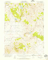
~ Observation Peak CA topo map, 1:62500 scale, 15 X 15 Minute, Historical, 1954, updated 1955
Observation Peak, California, USGS topographic map dated 1954.
Includes geographic coordinates (latitude and longitude). This topographic map is suitable for hiking, camping, and exploring, or framing it as a wall map.
Printed on-demand using high resolution imagery, on heavy weight and acid free paper, or alternatively on a variety of synthetic materials.
Topos available on paper, Waterproof, Poly, or Tyvek. Usually shipping rolled, unless combined with other folded maps in one order.
- Product Number: USGS-5679259
- Free digital map download (high-resolution, GeoPDF): Observation Peak, California (file size: 7 MB)
- Map Size: please refer to the dimensions of the GeoPDF map above
- Weight (paper map): ca. 55 grams
- Map Type: POD USGS Topographic Map
- Map Series: HTMC
- Map Verison: Historical
- Cell ID: 72760
- Scan ID: 298372
- Imprint Year: 1955
- Woodland Tint: Yes
- Aerial Photo Year: 1951
- Survey Year: 1954
- Datum: NAD27
- Map Projection: Polyconic
- Map published by United States Geological Survey
- Keywords: Overedge
- Map Language: English
- Scanner Resolution: 600 dpi
- Map Cell Name: Observation Peak
- Grid size: 15 X 15 Minute
- Date on map: 1954
- Map Scale: 1:62500
- Geographical region: California, United States
Neighboring Maps:
All neighboring USGS topo maps are available for sale online at a variety of scales.
Spatial coverage:
Topo map Observation Peak, California, covers the geographical area associated the following places:
- Accommodation Spring - Dodge Reservoir - Buckhorn Reservoir - Sugarloaf - Gerlach Spring - Dodge Reservoir - Painters Flat - Red Rock Number 3 230-003 Dam - Painters Creek - Cottonwood Creek - Painters Flat - Red Rock Creek - Madeline Ranch - Rager Reservoir - Round Corral Reservoir - Dunn Reservoir - Cold Spring Ranch - Dunn Reservoir - Rabbit Basin - Wire Corral Spring - Brine Spring - Big Spring - Bryant Spring - Pothole Spring - Red Rock Number 1 230 Dam - Dry Creek - Buckhorn 238 Dam - Rodeo Flat - Gallion Spring - Cold Spring - Harrison Spring - Horne Ranch - Hog Spring - Button Mountain - Powell Reservoir - Willow Lake - Union Reservoir - Cold Spring Valley - Buckhorn Canyon - Observation Peak - Dry Lake - Buckhorn Lake - Cottonwood Mountains
- Map Area ID: AREA4140.75-120.25-120
- Northwest corner Lat/Long code: USGSNW41-120.25
- Northeast corner Lat/Long code: USGSNE41-120
- Southwest corner Lat/Long code: USGSSW40.75-120.25
- Southeast corner Lat/Long code: USGSSE40.75-120
- Northern map edge Latitude: 41
- Southern map edge Latitude: 40.75
- Western map edge Longitude: -120.25
- Eastern map edge Longitude: -120


