
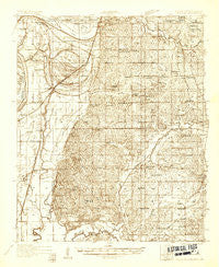
~ Horn Lake MS topo map, 1:48000 scale, 15 X 15 Minute, Historical, 1932
Horn Lake, Mississippi, USGS topographic map dated 1932.
Includes geographic coordinates (latitude and longitude). This topographic map is suitable for hiking, camping, and exploring, or framing it as a wall map.
Printed on-demand using high resolution imagery, on heavy weight and acid free paper, or alternatively on a variety of synthetic materials.
Topos available on paper, Waterproof, Poly, or Tyvek. Usually shipping rolled, unless combined with other folded maps in one order.
- Product Number: USGS-5678676
- Free digital map download (high-resolution, GeoPDF): Horn Lake, Mississippi (file size: 14 MB)
- Map Size: please refer to the dimensions of the GeoPDF map above
- Weight (paper map): ca. 55 grams
- Map Type: POD USGS Topographic Map
- Map Series: HTMC
- Map Verison: Historical
- Cell ID: 55479
- Scan ID: 336772
- Survey Year: 1932
- Datum: NAD
- Map Projection: Polyconic
- Advance: Yes
- Map published by United States Geological Survey
- Map published by United States Army Corps of Engineers
- Map published by United States Department of War
- Keywords: Overedge; Nonstandard Press Run
- Map Language: English
- Scanner Resolution: 600 dpi
- Map Cell Name: Horn Lake
- Grid size: 15 X 15 Minute
- Date on map: 1932
- Map Scale: 1:48000
- Geographical region: Mississippi, United States
Neighboring Maps:
All neighboring USGS topo maps are available for sale online at a variety of scales.
Spatial coverage:
Topo map Horn Lake, Mississippi, covers the geographical area associated the following places:
- Deans Corner - Aldens - Eudora - Blue Goose (historical) - Holly Hills - Scaife - Lynchburg - Walls - Lake Cormorant - Horn Lake - Robinson Gin - Norfolk - Lake View - Banks - Cub Lake - Glover - Southaven - De Soto Village - Lost Lake - West Days - Twin Lakes - Pleasant Hill - Marienette - Barnesville - Nesbit - Days - Trinity - Green River
- Map Area ID: AREA3534.75-90.25-90
- Northwest corner Lat/Long code: USGSNW35-90.25
- Northeast corner Lat/Long code: USGSNE35-90
- Southwest corner Lat/Long code: USGSSW34.75-90.25
- Southeast corner Lat/Long code: USGSSE34.75-90
- Northern map edge Latitude: 35
- Southern map edge Latitude: 34.75
- Western map edge Longitude: -90.25
- Eastern map edge Longitude: -90


