
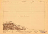
~ Higginsport OH topo map, 1:48000 scale, 15 X 15 Minute, Historical, 1928
Higginsport, Ohio, USGS topographic map dated 1928.
Includes geographic coordinates (latitude and longitude). This topographic map is suitable for hiking, camping, and exploring, or framing it as a wall map.
Printed on-demand using high resolution imagery, on heavy weight and acid free paper, or alternatively on a variety of synthetic materials.
Topos available on paper, Waterproof, Poly, or Tyvek. Usually shipping rolled, unless combined with other folded maps in one order.
- Product Number: USGS-5678560
- Free digital map download (high-resolution, GeoPDF): Higginsport, Ohio (file size: 3 MB)
- Map Size: please refer to the dimensions of the GeoPDF map above
- Weight (paper map): ca. 55 grams
- Map Type: POD USGS Topographic Map
- Map Series: HTMC
- Map Verison: Historical
- Cell ID: 55320
- Scan ID: 804206
- Survey Year: 1928
- Datum: NAD
- Map Projection: Polyconic
- Advance: Yes
- Map published by United States Geological Survey
- Keywords: Overedge; Nonstandard Press Run
- Map Language: English
- Scanner Resolution: 508 dpi
- Map Cell Name: Higginsport
- Grid size: 15 X 15 Minute
- Date on map: 1928
- Map Scale: 1:48000
- Geographical region: Ohio, United States
Neighboring Maps:
All neighboring USGS topo maps are available for sale online at a variety of scales.
Spatial coverage:
Topo map Higginsport, Ohio, covers the geographical area associated the following places:
- Whiteoak Springs (historical) - Port Chardon Mobile Home Park - Shiloh - Wahlsburg - New Hope - Reeds - East Wahlsburg - Hamersville - Ash Ridge - West Arnheim - Higginsport - Brownstown - Feesburg - Redoak - Five Points - Hammond Mobile Home Park - South Higginsport - Georgetown - Dover - Sunshine (historical) - Neals Corner - Centerpoint - North Feesburg (historical) - Eastland Mobile Home Park - Hillman (historical) - White Oak Valley - Stoney Point - Arnheim - Levanna - Stringtown - Russellville
- Map Area ID: AREA3938.75-84-83.75
- Northwest corner Lat/Long code: USGSNW39-84
- Northeast corner Lat/Long code: USGSNE39-83.75
- Southwest corner Lat/Long code: USGSSW38.75-84
- Southeast corner Lat/Long code: USGSSE38.75-83.75
- Northern map edge Latitude: 39
- Southern map edge Latitude: 38.75
- Western map edge Longitude: -84
- Eastern map edge Longitude: -83.75


