
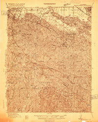
~ New Almaden CA topo map, 1:48000 scale, 15 X 15 Minute, Historical, 1916
New Almaden, California, USGS topographic map dated 1916.
Includes geographic coordinates (latitude and longitude). This topographic map is suitable for hiking, camping, and exploring, or framing it as a wall map.
Printed on-demand using high resolution imagery, on heavy weight and acid free paper, or alternatively on a variety of synthetic materials.
Topos available on paper, Waterproof, Poly, or Tyvek. Usually shipping rolled, unless combined with other folded maps in one order.
- Product Number: USGS-5678424
- Free digital map download (high-resolution, GeoPDF): New Almaden, California (file size: 19 MB)
- Map Size: please refer to the dimensions of the GeoPDF map above
- Weight (paper map): ca. 55 grams
- Map Type: POD USGS Topographic Map
- Map Series: HTMC
- Map Verison: Historical
- Cell ID: 56917
- Scan ID: 296631
- Survey Year: 1916
- Datum: Unstated
- Map Projection: Unstated
- Advance: Yes
- Map published by United States Geological Survey
- Keywords: Overedge; Nonstandard Press Run
- Map Language: English
- Scanner Resolution: 600 dpi
- Map Cell Name: Los Gatos
- Grid size: 15 X 15 Minute
- Date on map: 1916
- Map Scale: 1:48000
- Geographical region: California, United States
Neighboring Maps:
All neighboring USGS topo maps are available for sale online at a variety of scales.
Spatial coverage:
Topo map New Almaden, California, covers the geographical area associated the following places:
- Highland (historical) - Pomar (historical) - Olive Springs (historical) - Bethany Park - Glenwood - Alma (historical) - Mountain Home - Day Valley - Holy City - Fontenay Villa - Greystone (historical) - Shannon - Clems (historical) - Redwood Estates - English Town - Sveadal - Guadalupe (historical) - Redwood Lodge - Laurel - Magnetic Spring (historical) - Rinconada - Twin Creeks - Los Gatos - Lexington Hills - Chemeketa Park - Los Gatos Trailer Park - Monte Sereno - Aldercroft Heights - New Almaden - Austin - The Willows - Lexington (historical)
- Map Area ID: AREA37.2537-122-121.75
- Northwest corner Lat/Long code: USGSNW37.25-122
- Northeast corner Lat/Long code: USGSNE37.25-121.75
- Southwest corner Lat/Long code: USGSSW37-122
- Southeast corner Lat/Long code: USGSSE37-121.75
- Northern map edge Latitude: 37.25
- Southern map edge Latitude: 37
- Western map edge Longitude: -122
- Eastern map edge Longitude: -121.75


