
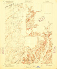
~ Buffalo Creek CA topo map, 1:31680 scale, 7.5 X 7.5 Minute, Historical, 1916
Buffalo Creek, California, USGS topographic map dated 1916.
Includes geographic coordinates (latitude and longitude). This topographic map is suitable for hiking, camping, and exploring, or framing it as a wall map.
Printed on-demand using high resolution imagery, on heavy weight and acid free paper, or alternatively on a variety of synthetic materials.
Topos available on paper, Waterproof, Poly, or Tyvek. Usually shipping rolled, unless combined with other folded maps in one order.
- Product Number: USGS-5677920
- Free digital map download (high-resolution, GeoPDF): Buffalo Creek, California (file size: 6 MB)
- Map Size: please refer to the dimensions of the GeoPDF map above
- Weight (paper map): ca. 55 grams
- Map Type: POD USGS Topographic Map
- Map Series: HTMC
- Map Verison: Historical
- Cell ID: 6032
- Scan ID: 295955
- Survey Year: 1908
- Datum: Unstated
- Map Projection: Unstated
- Map published by United States Geological Survey
- Keywords: Inset
- Map Language: English
- Scanner Resolution: 600 dpi
- Map Cell Name: Buffalo Creek
- Grid size: 7.5 X 7.5 Minute
- Date on map: 1916
- Map Scale: 1:31680
- Geographical region: California, United States
Neighboring Maps:
All neighboring USGS topo maps are available for sale online at a variety of scales.
Spatial coverage:
Topo map Buffalo Creek, California, covers the geographical area associated the following places:
- KPTO-AM (Sloughhouse) - Kiefer Landfill - Coyote Creek - Sacramento Metropolitan Fire District Station 68 - Crevis Creek - Prairie City State Vehicular Recreation Area - Carson Creek - Carson Creek Junior Senior High School - Rebel Hill Ditch - Blodgett Reservoir - Sacramento County Boy's Ranch - KSMJ-AM (Sacramento) - Blodgett 454 Dam
- Map Area ID: AREA38.62538.5-121.25-121.125
- Northwest corner Lat/Long code: USGSNW38.625-121.25
- Northeast corner Lat/Long code: USGSNE38.625-121.125
- Southwest corner Lat/Long code: USGSSW38.5-121.25
- Southeast corner Lat/Long code: USGSSE38.5-121.125
- Northern map edge Latitude: 38.625
- Southern map edge Latitude: 38.5
- Western map edge Longitude: -121.25
- Eastern map edge Longitude: -121.125


